Road Trip! Detroit to Houston for the National Championship & Plenty of History Along The Way
What an epic trip to see my Michigan Wolverines win the National Championship in Houston! My son Tony and I drove from Michigan which is a pretty good distance (around 20 hours of actual driving each way) and we saw a LOT of stuff along the way even though we didn’t have a ton of time…

DISCLAIMER: I had a heck of a time getting the images to upload properly on this blog post. I tried Squarespace support and Apple support, I had to re-export the photos and then re-export them again on some of them and I feel like the quality degraded a bit here and there. My apologies if the quality of some of the images aren’t perfect. Not happy about it but I think they’re still good enough to tell the story and do the job. Part of my fix going forward (and it’s a good tip) is to set my iPhone 15 Pro to “Most Compatible” instead of “High Efficiency” under Settings > Camera > Format which allows you to shoot in JPEG in the first place instead of HEIC.
Okay back to the roadtrip. Here’s the route:

Yep that’s a lot of driving to spend less than two days at the main destination, but it’s the journey that is always a big part of the fun and the multiple destinations along the way that keeps me coming back for more of these roadies - especially historical sites that I would only see if I did these trips. We’ll start in Little Rock where we stayed the first night. Neither of us had ever been to the state of Arkansas and for me that makes 39 United States (and 2 territories).
Little Rock, Arkansas
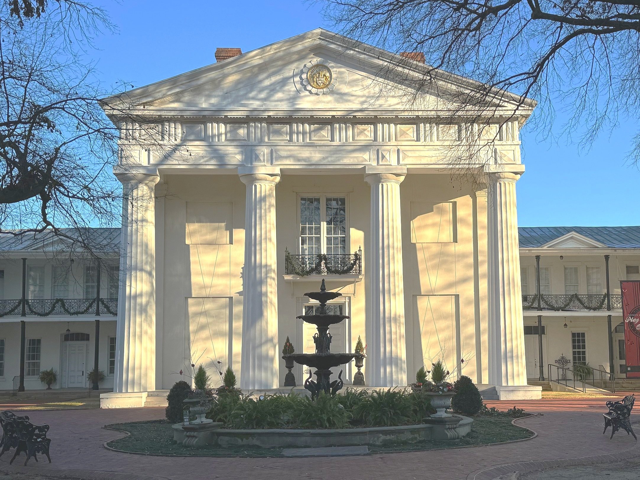
Little Rock actually has a pretty cool downtown - seems clean with plenty to do and it’s right on the Wabash River. It’s nice! We saw some very cool historical sites there, starting with the Old State House. It’s the original capitol building and the oldest one still standing west of the Mississippi. It’s a museum now but we were there before it opened. They started construction on it in 1833 and this is where the state legislature voted to secede from the Union in 1861. I would love to get back there and see inside one day - but who knows when I’ll make it back to Little Rock - took me over a half century to get there lol… There’s also a virtual tour at the website (linked above) that does the trick.

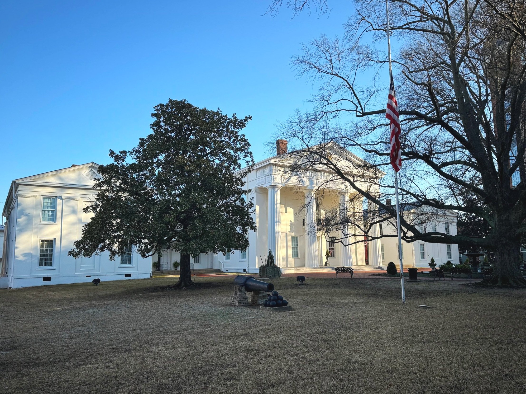
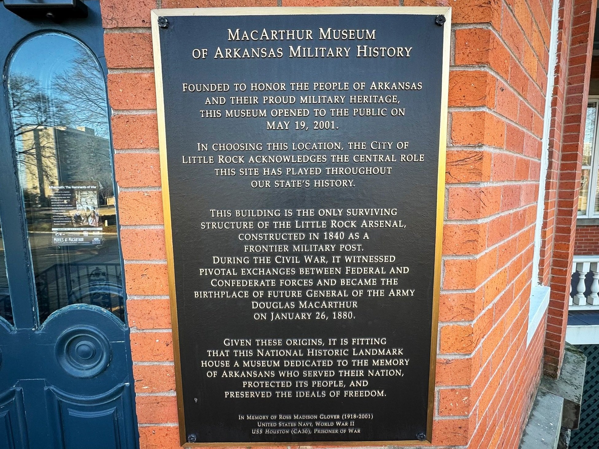
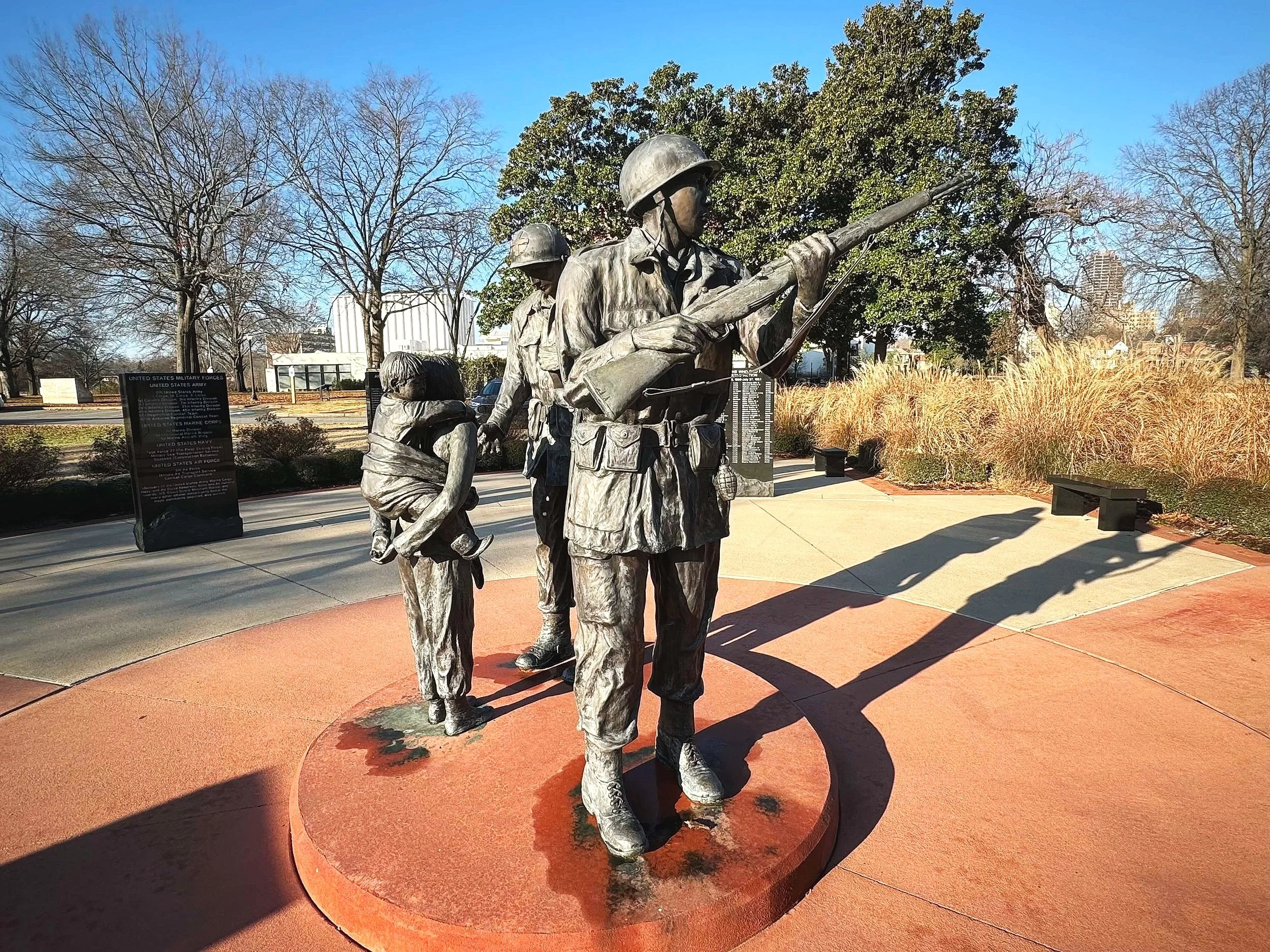
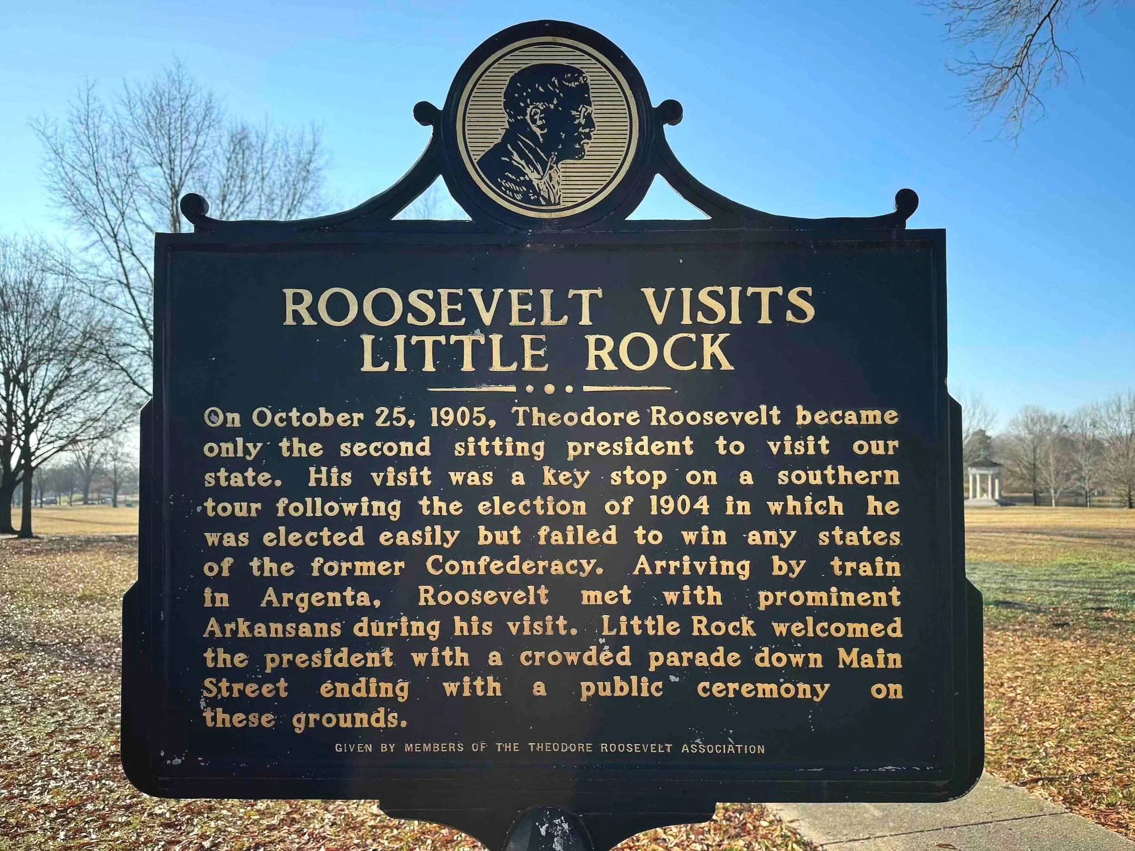
Next up is the MacArthur Museum of Arkansas Military History and once again we did not go in, but the grounds are really nice and the building is actually the one that General Douglas MacArthur was born in because it was an Army Barracks at the time. MacArthur’s father Arthur was seriously wounded at the Civil War Battle of Franklin (which we also visited on this trip). The building is the only remaining one from the complex of buildings that made up the Little Rock Arsenal at the time, and there are memorials on the grounds including a handsome Korean War memorial along with a marker commemorating when Teddy Roosevelt visited the spot. There are also markers denoting that this was the spot the Camden Expedition embarked from in 1864 when Union Soldiers attempted to march south to gain control of Shreveport - we visited the Battlefield of Poison Springs from that campaign - more on that in a bit.


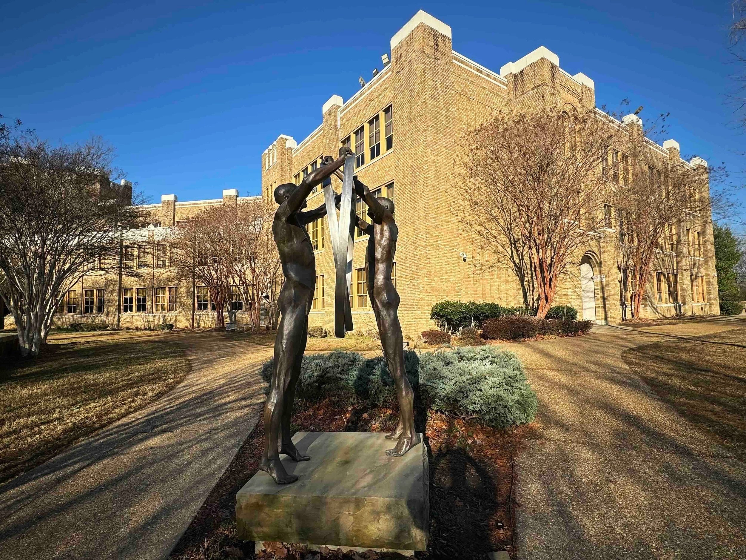
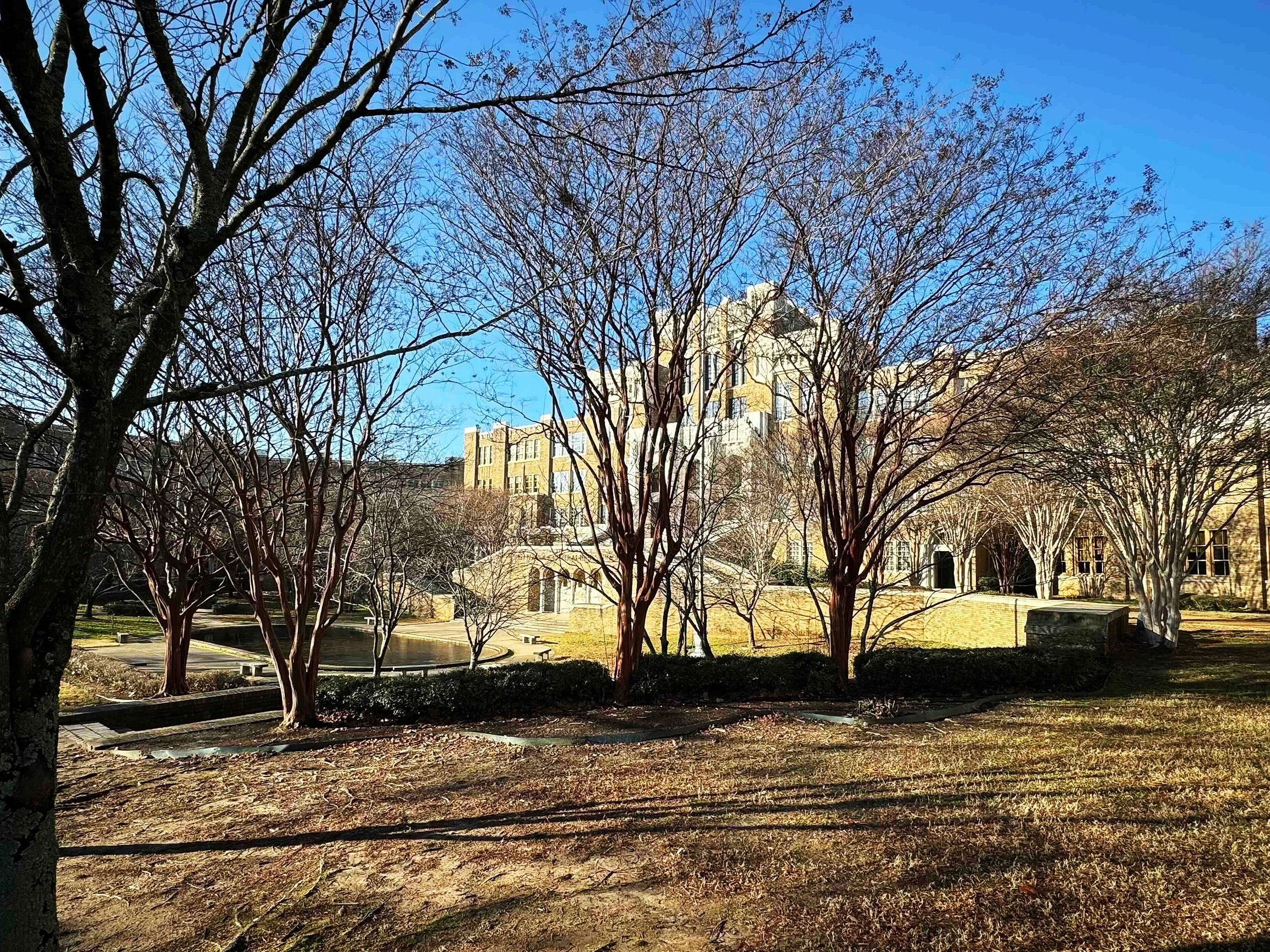
The next one was pretty intense. Unlike the first two landmarks this one was one I had seen in photos and it was kind of a whoa moment when you turn left and see there on your right Little Rock Central High School. A majestic looking castle like structure that was the scene of a pivotal moment in the Civil Rights movement when the Little Rock Nine integrated the school to help hasten the end of segregation in the South. I walked up those very steps that those courageous African American students did on their first day while enduring racist epithets and more… It gave me chills. It’s still an operating high school and again there is more to see along with a visitor’s center - we simply didn’t have time - we had to get on the road to Houston.


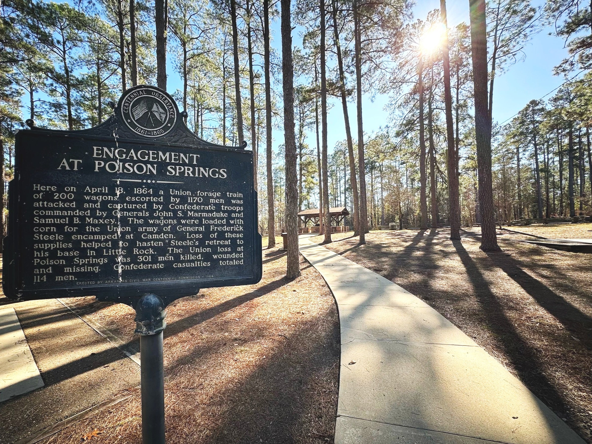
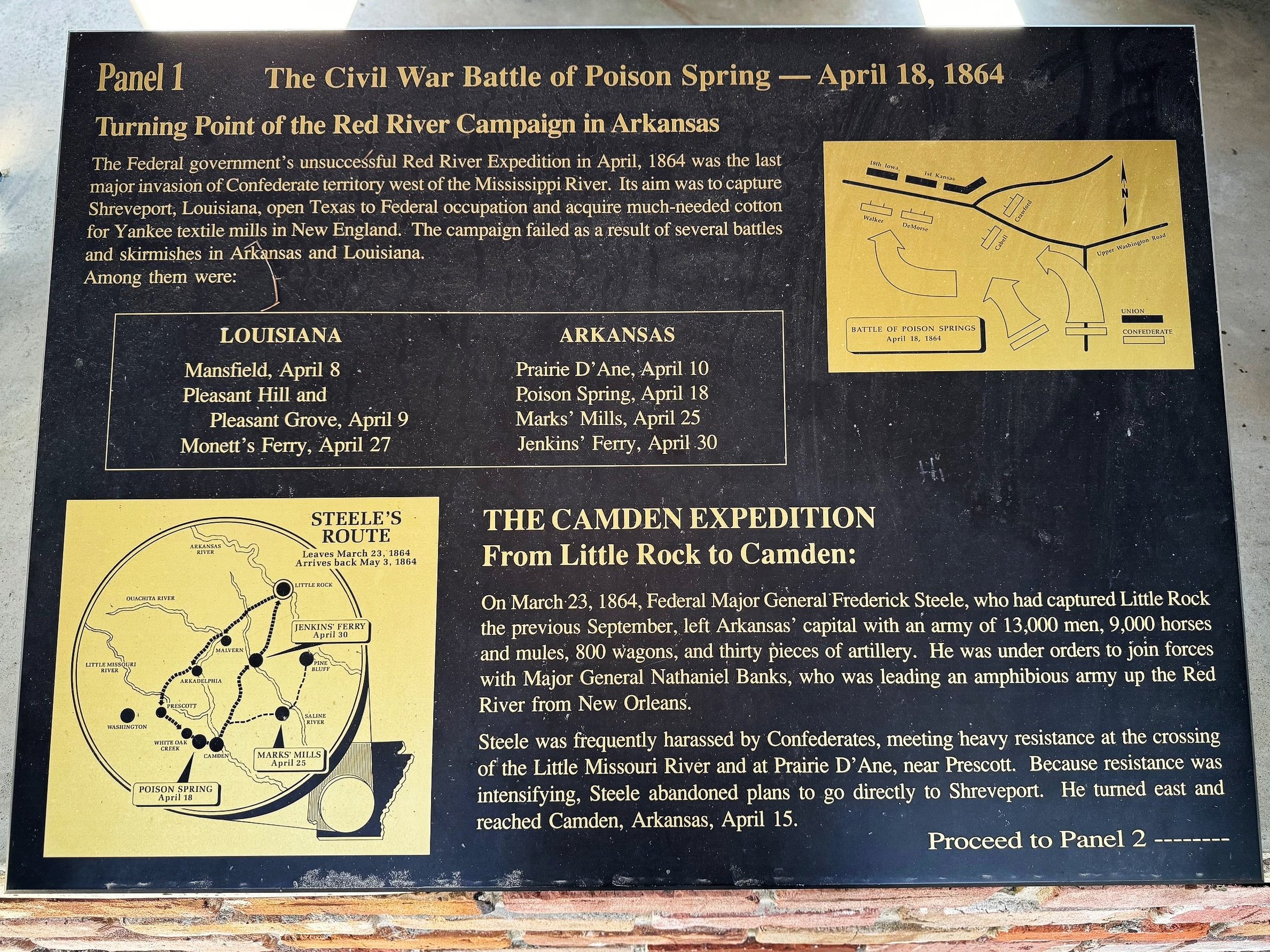
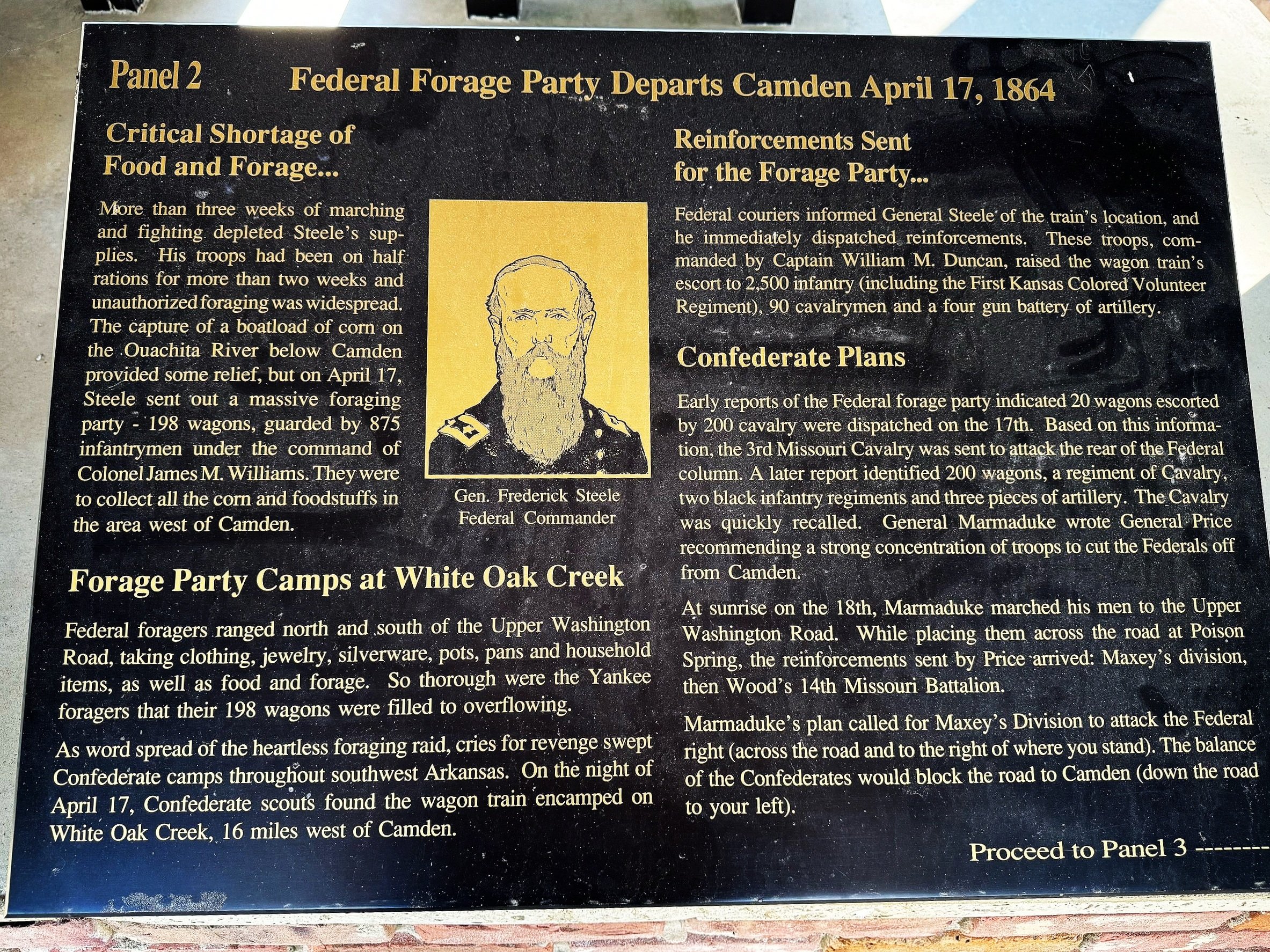
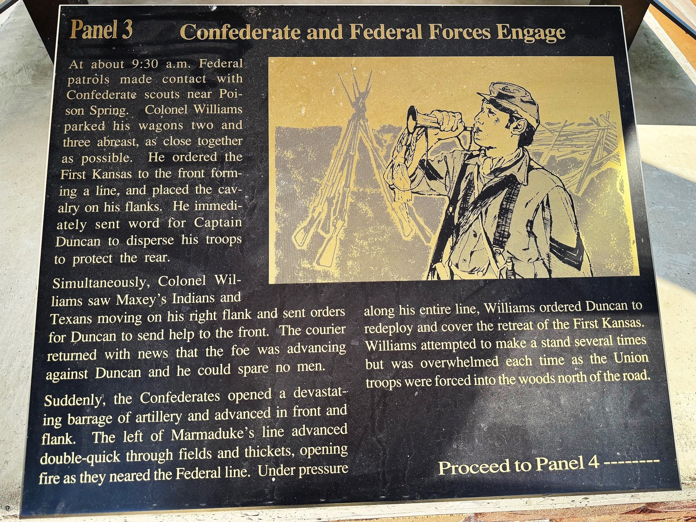
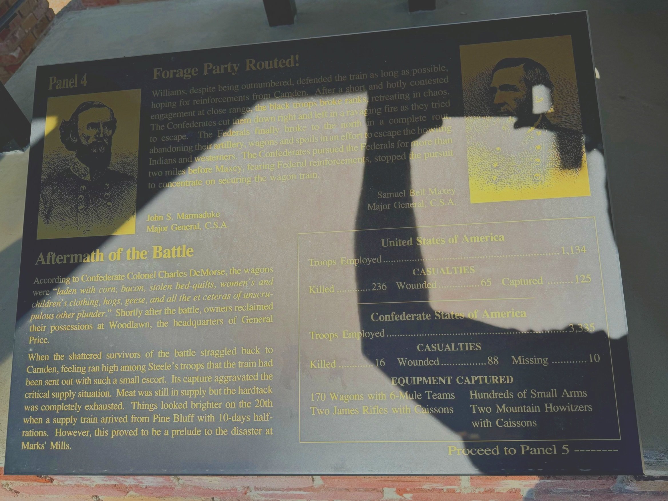
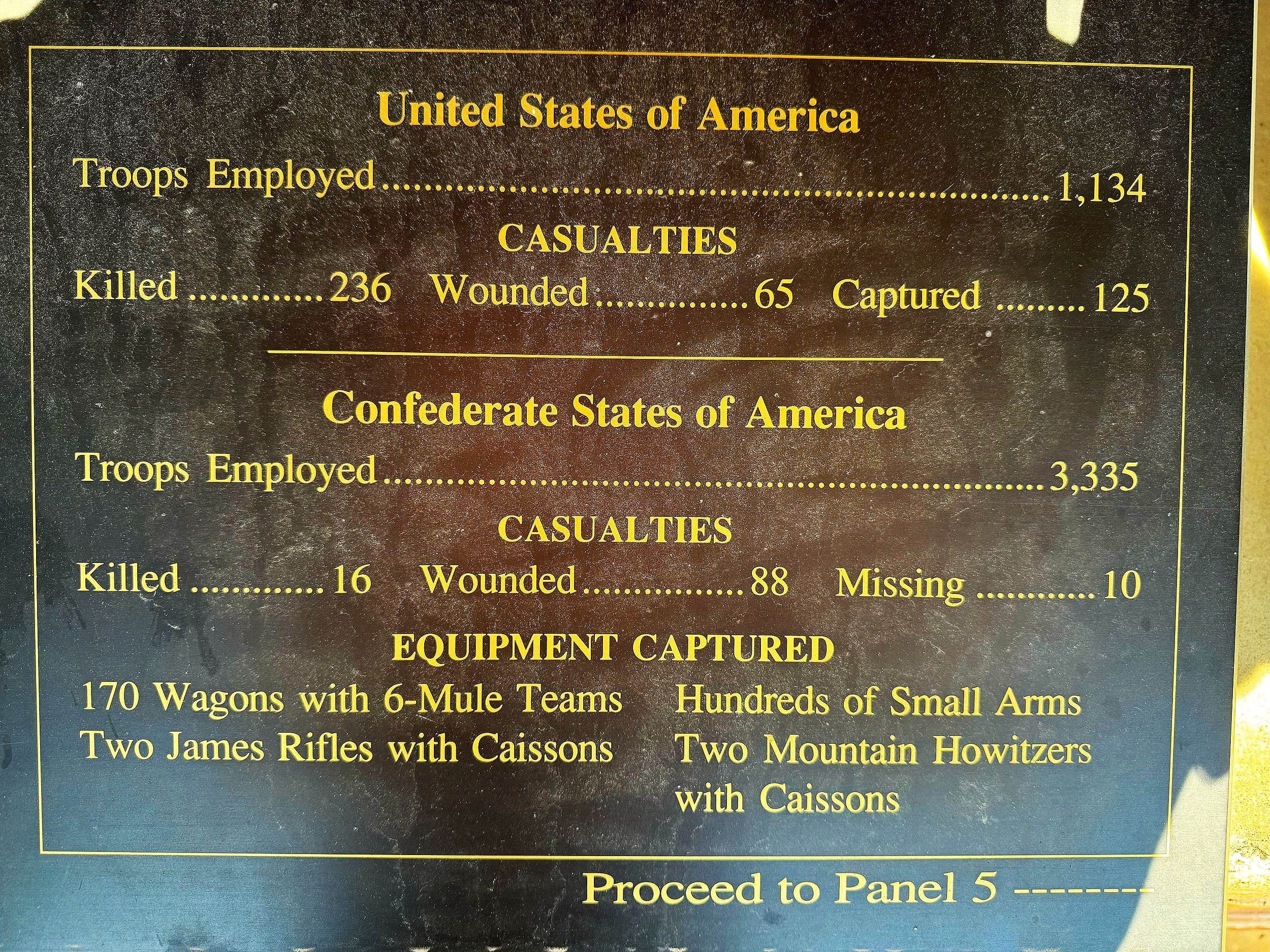
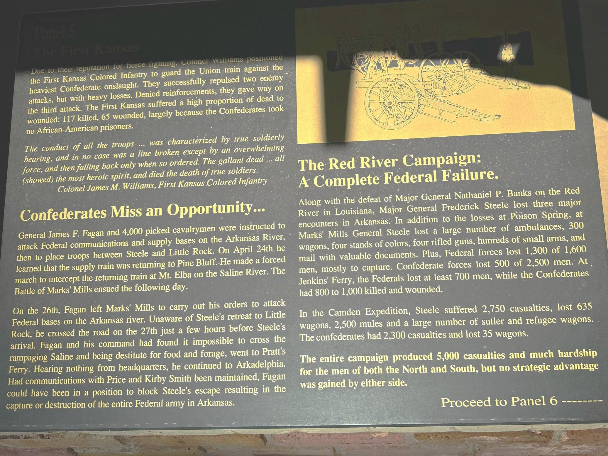
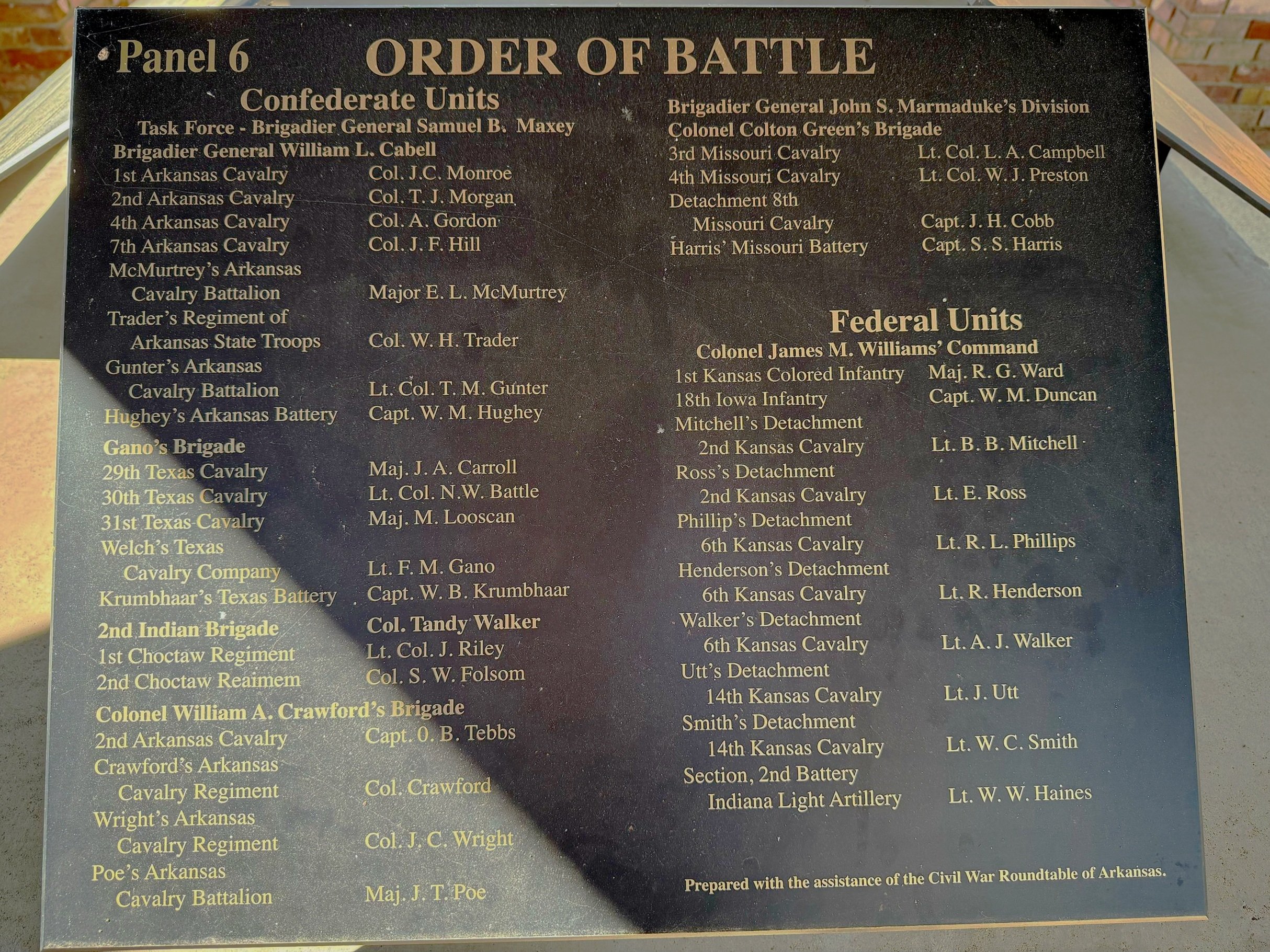
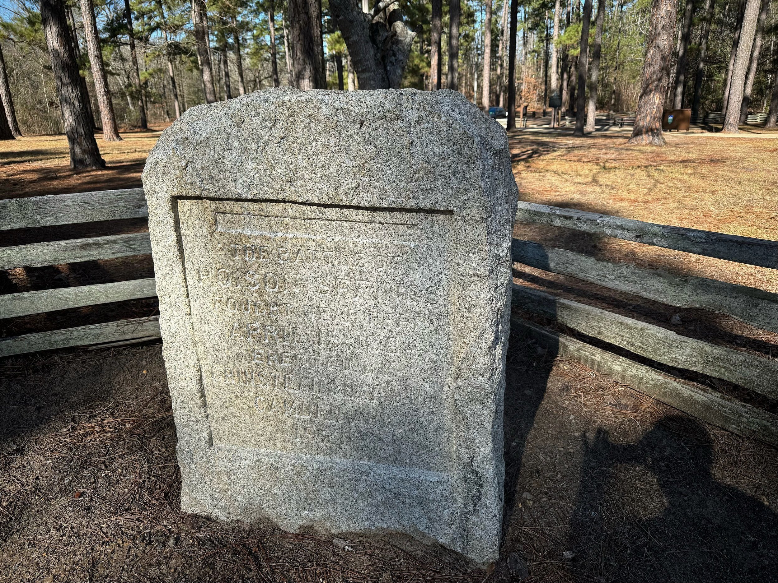
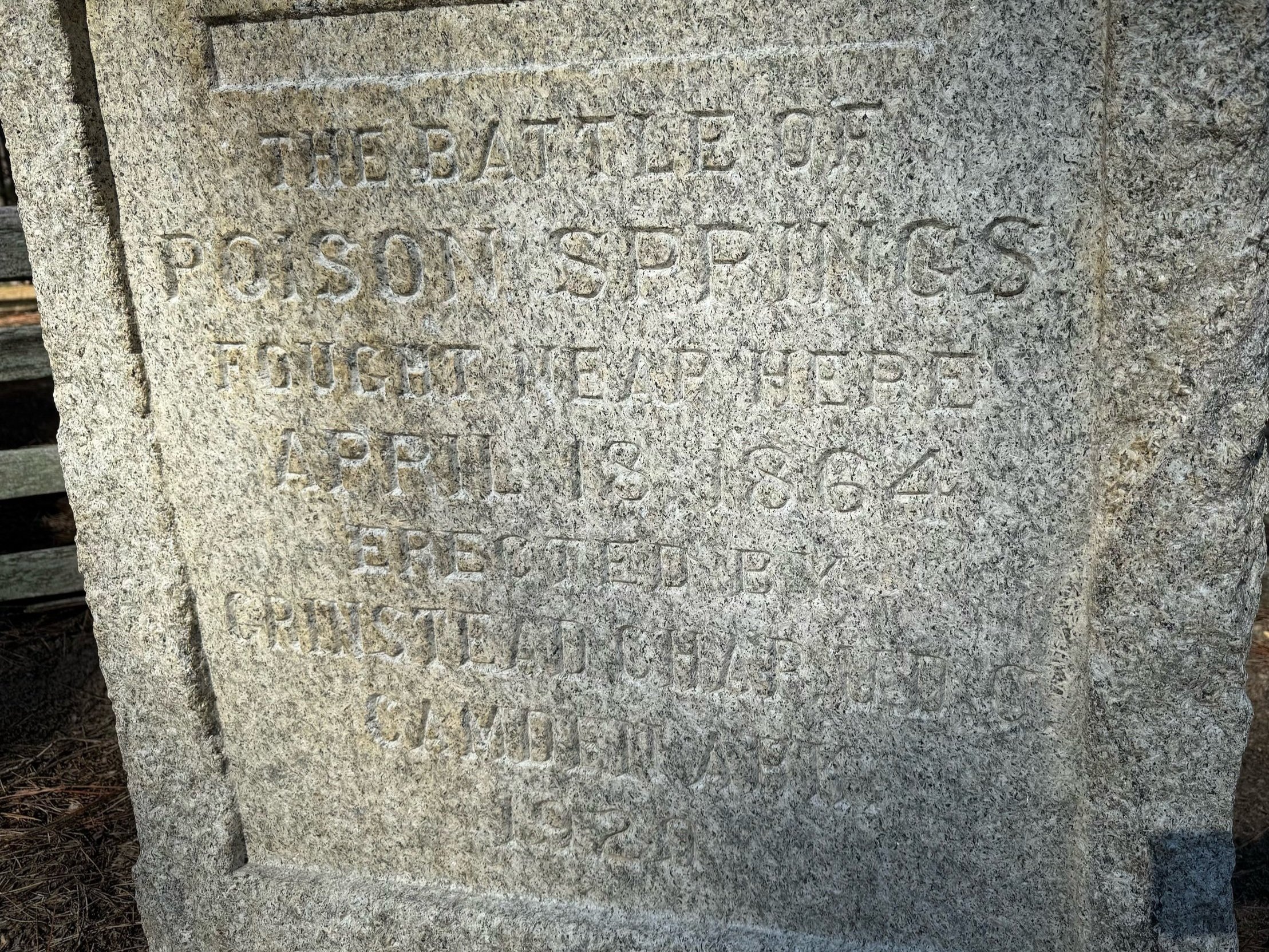
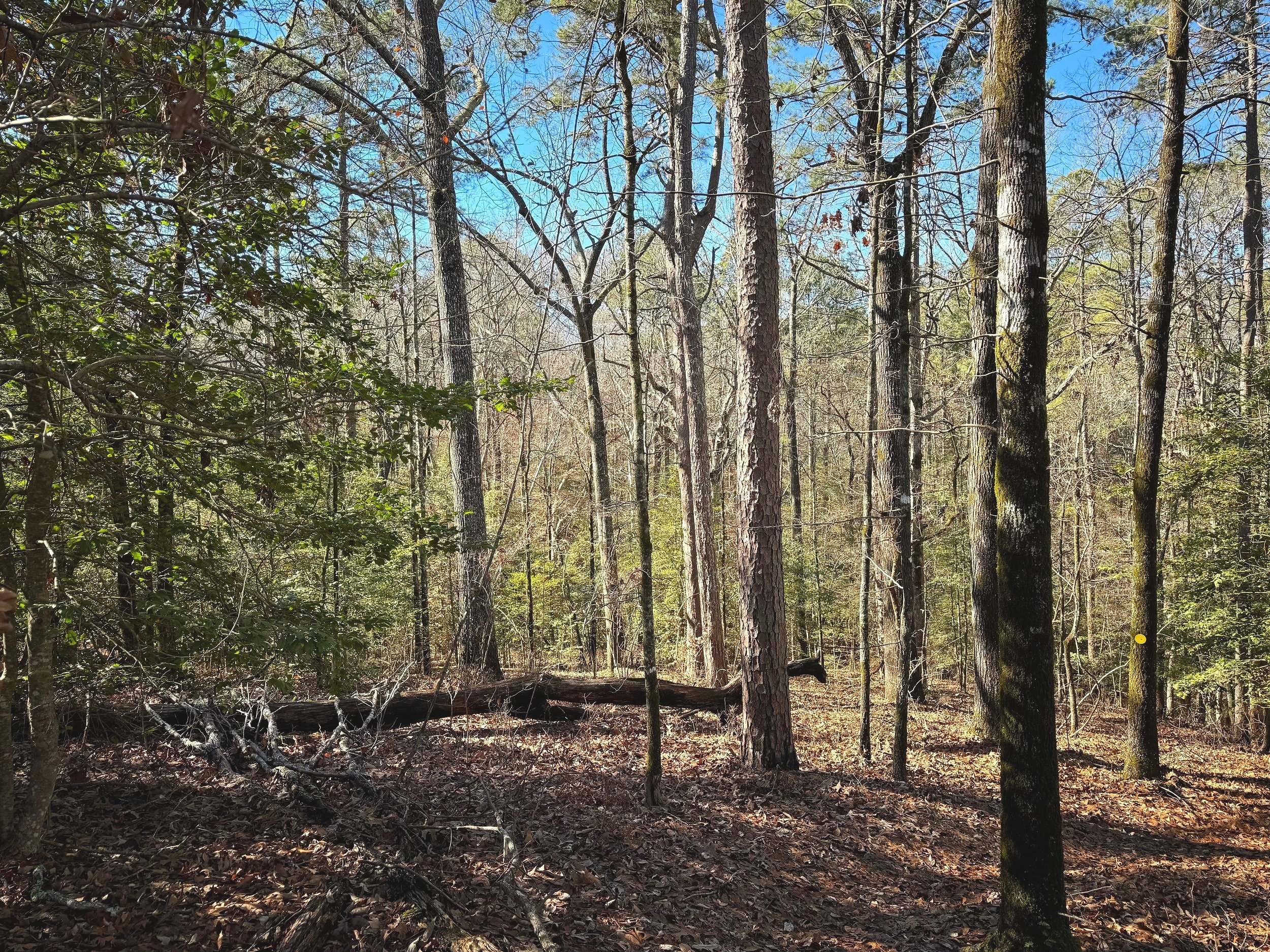
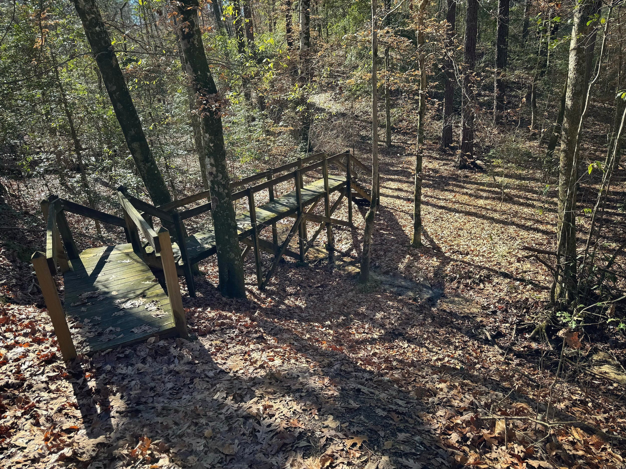
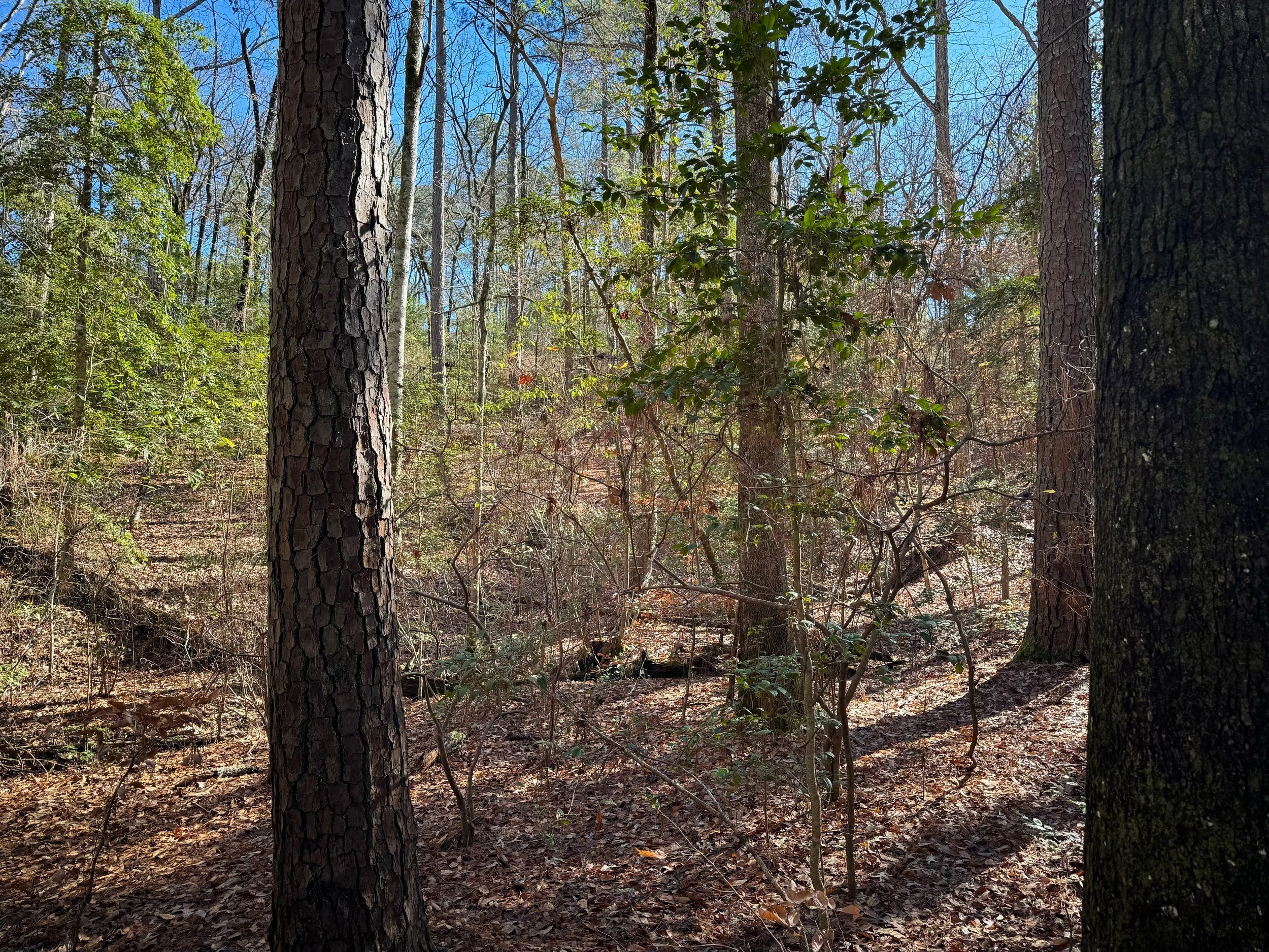
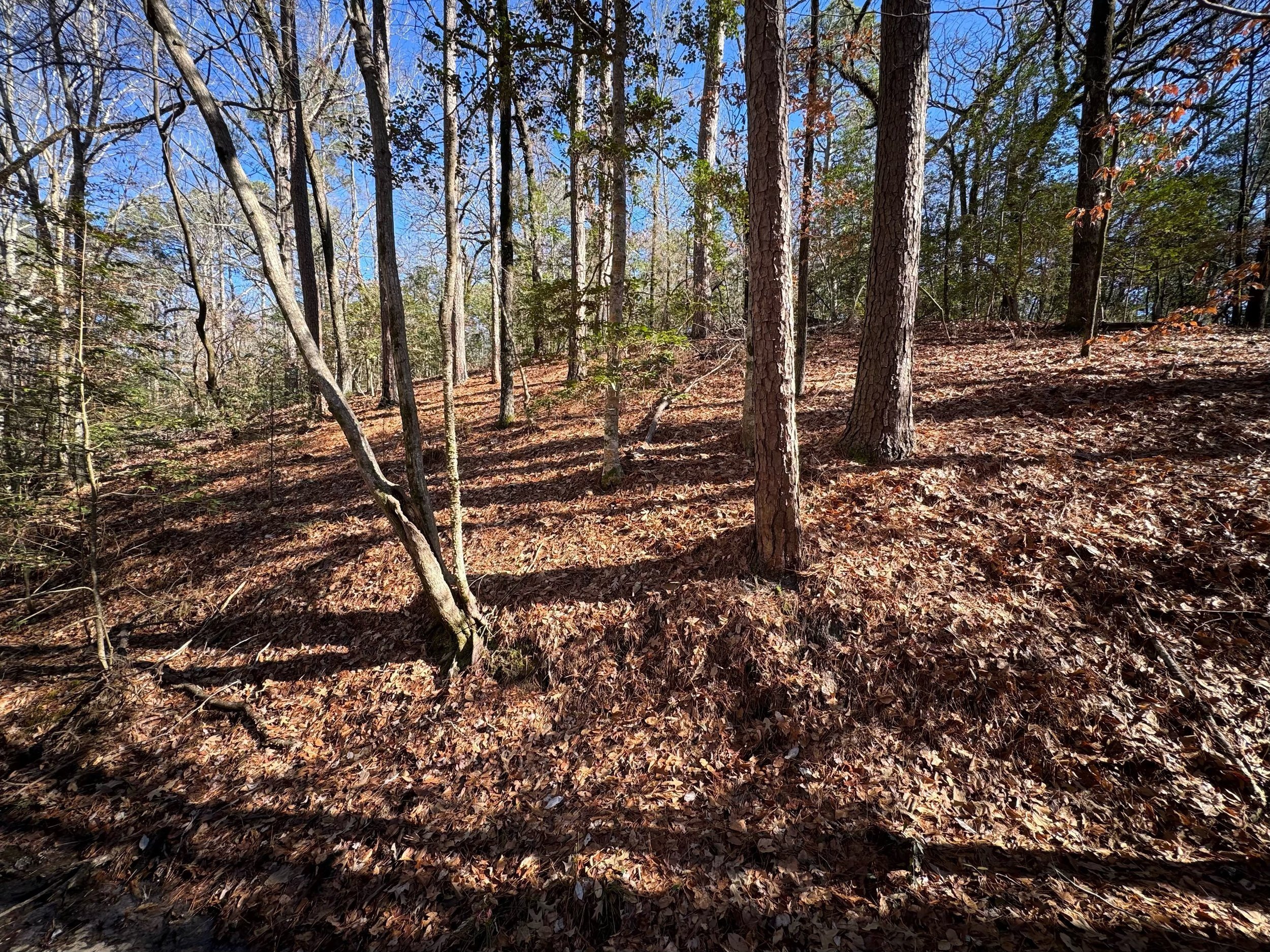
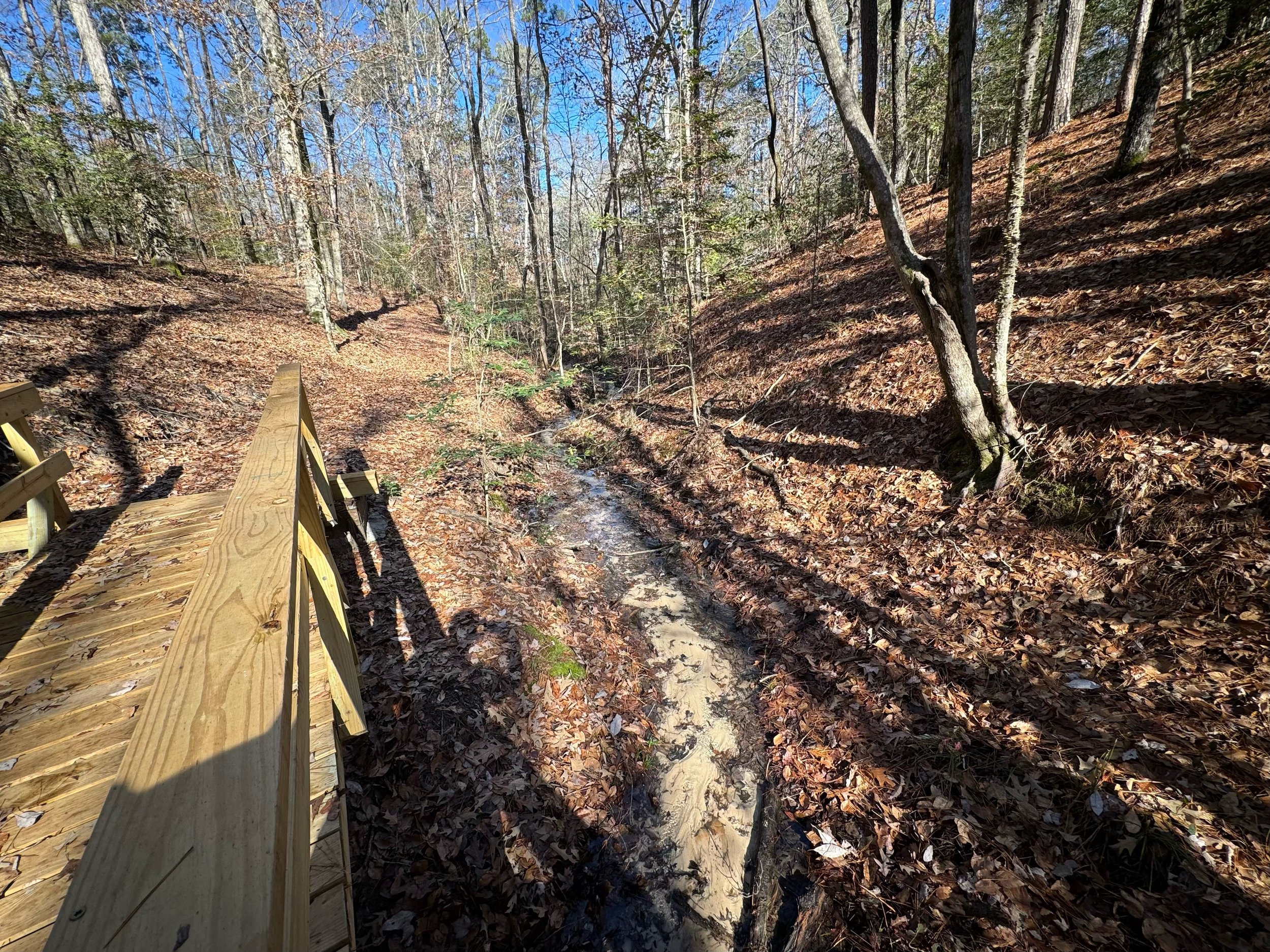
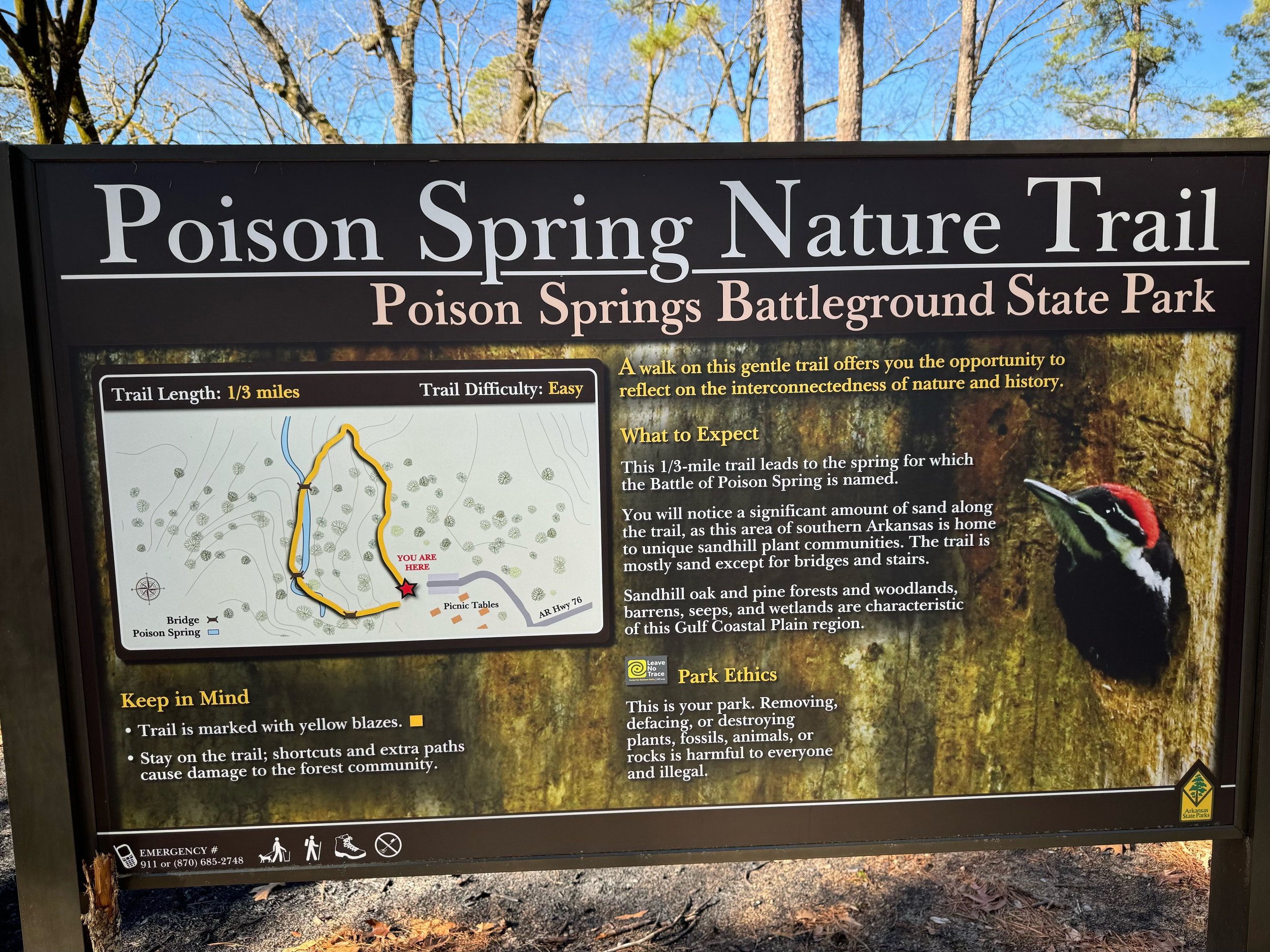
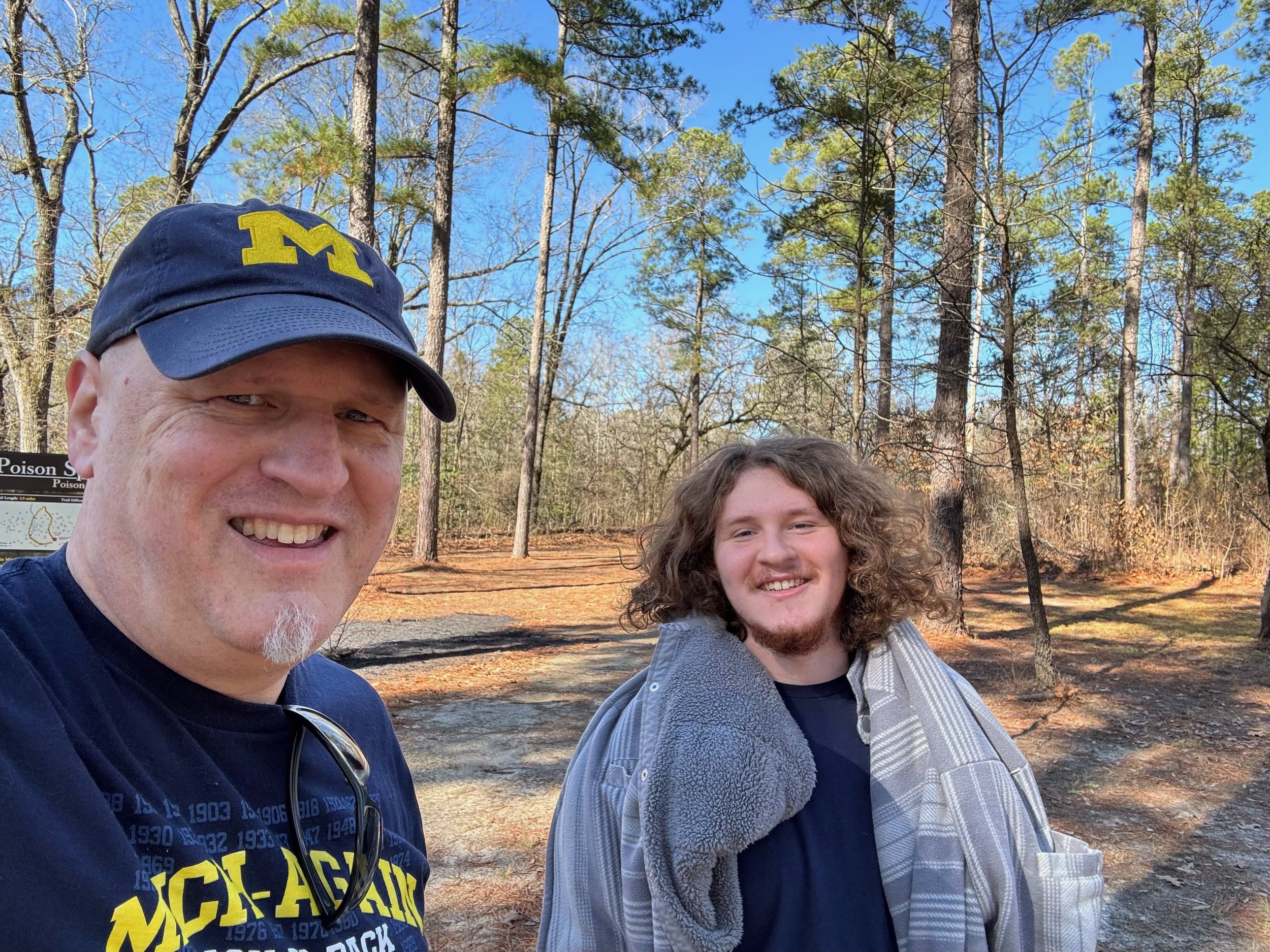
Poison Springs Battlefield
This little battlefield park was a bit off the beaten path and the terrain was pretty desolate and uninviting for an army to my eyes. A bit swampy and dense, and sure enough there was mention at the battlefield on the markers that the soldiers struggled to forage and subsist off the land - they were running out of rations on this campaign south. The goal of the Camden Expedition was for Union forces to leave from Little Rock which was now in Union control to try to meet up with Major General Nathanial Banks to take Shreveport and ultimately make a push into Texas. The campaign was led by Brigadier General Frederick Steele but it proved to be unsuccessful as the Confederates ultimately forced the Union soldiers to turn back towards Little Rock. The Poison Springs Battlefield is a state park with a little pavilion housing mutliple plaques that explain the battle in detail and there is a little loop trail that is unmarked. I can’t say I really had my bearings in terms of what exactly happened where along the trail but you get a feel for the terrain and the trail is well maintained.
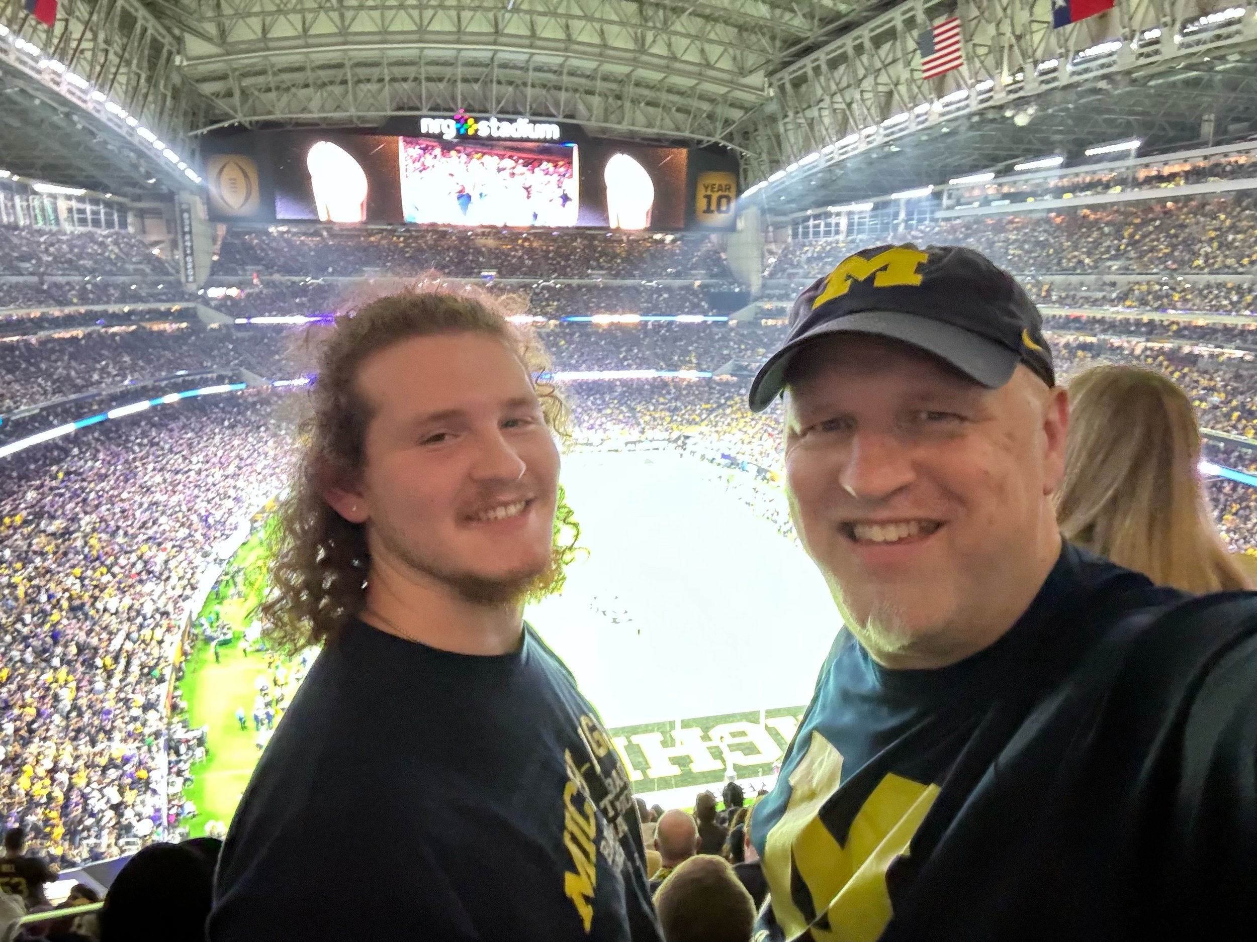
Houston - GO BLUE!
I won’t spend a ton of time here on Michigan’s National Championship since the focus of this blog is history, but wow…. Michigan took over that town and the Wolverines got it done! An awesome time with many friends and former teammates of mine. What a season. I’ve been to Houston a few times and the first time was for the 1981 Bluebonnet Bowl to see Michigan play UCLA at the Astrodome. So this was a bit surreal being back in Houston to see us win a title and walk right by the Astrodome which is now a relic of a bygone era…. it looks tiny next to NRG Stadium - you can see part of it in one of the photos below as we walked up to the stadium. I don’t typically take much video at concerts or games - sometimes at a big game I’ll take a little video to capture the scene and at this one I just happened to be recording when Mikey Sainristil sealed the game with an interception late in the game - I love having that play on video as I saw it, and I got lucky to keep the whole play in the frame since I was just holding my phone up but watching the game with my own eyes… Anyway, Michigan vs. Everybody, BET (if you know you know), HAIL to the Victors and GO BLUE!!!


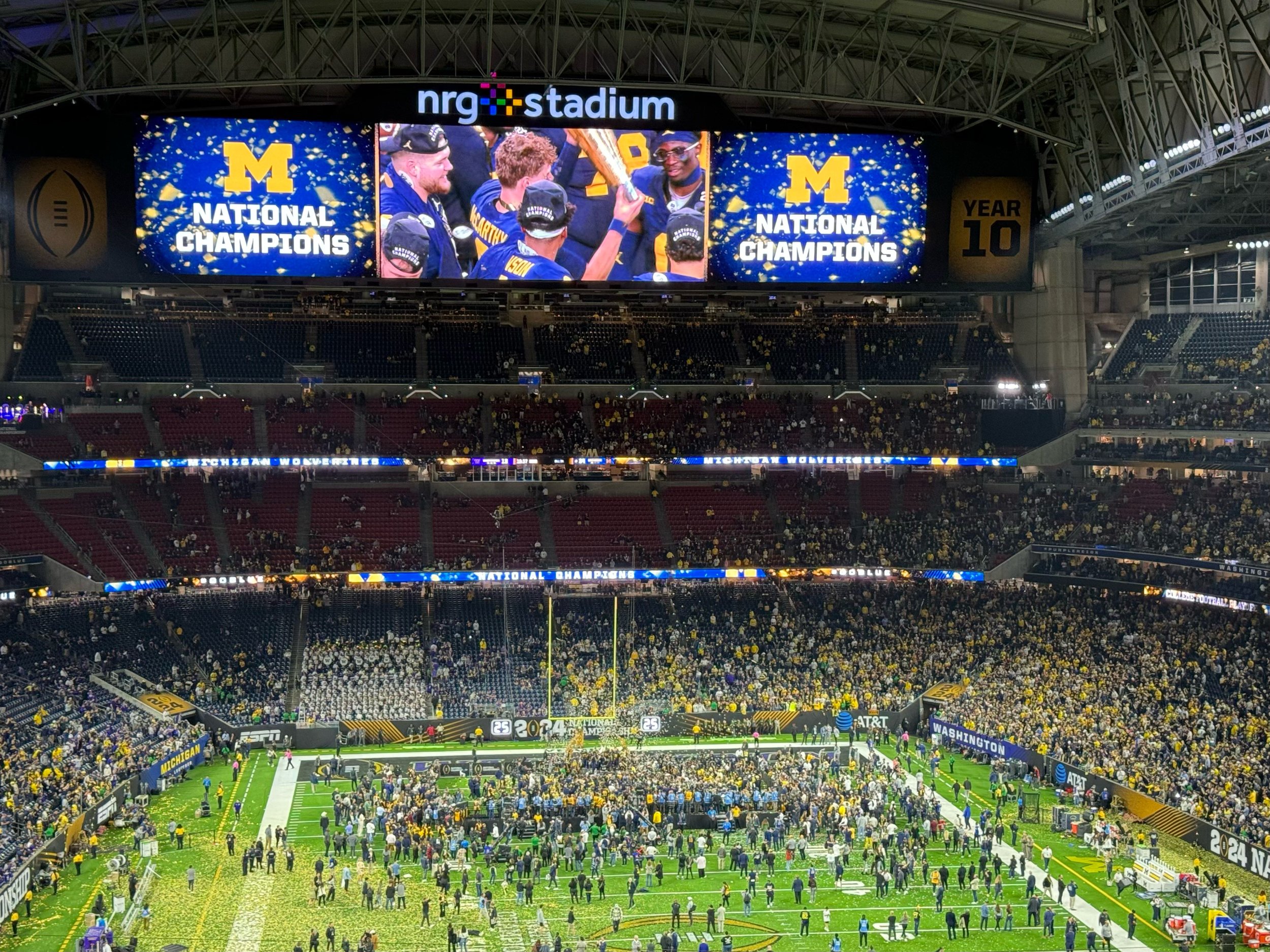
You could feel it - 4th and 13 and we could taste the victory…. 75% of the stadium was Maize and Blue and doing the Seven Nation Army chant (song created by Detroit, Michigan natives The White Stripes). The place erupted. We waited a long time for this.
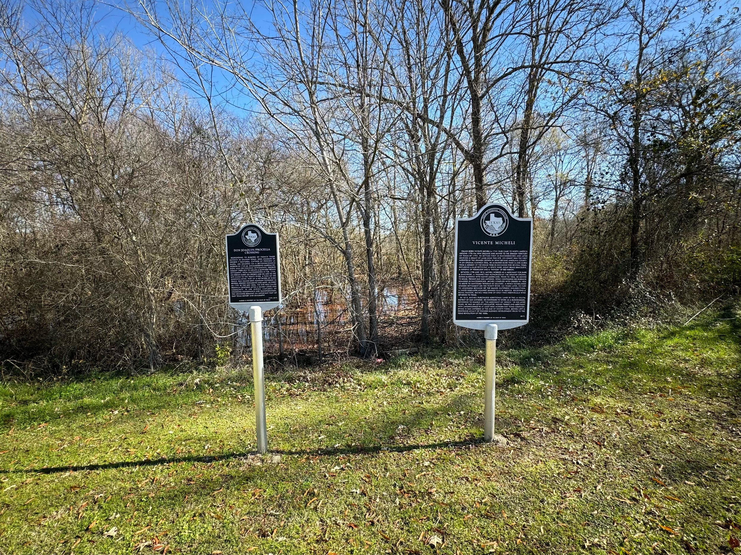
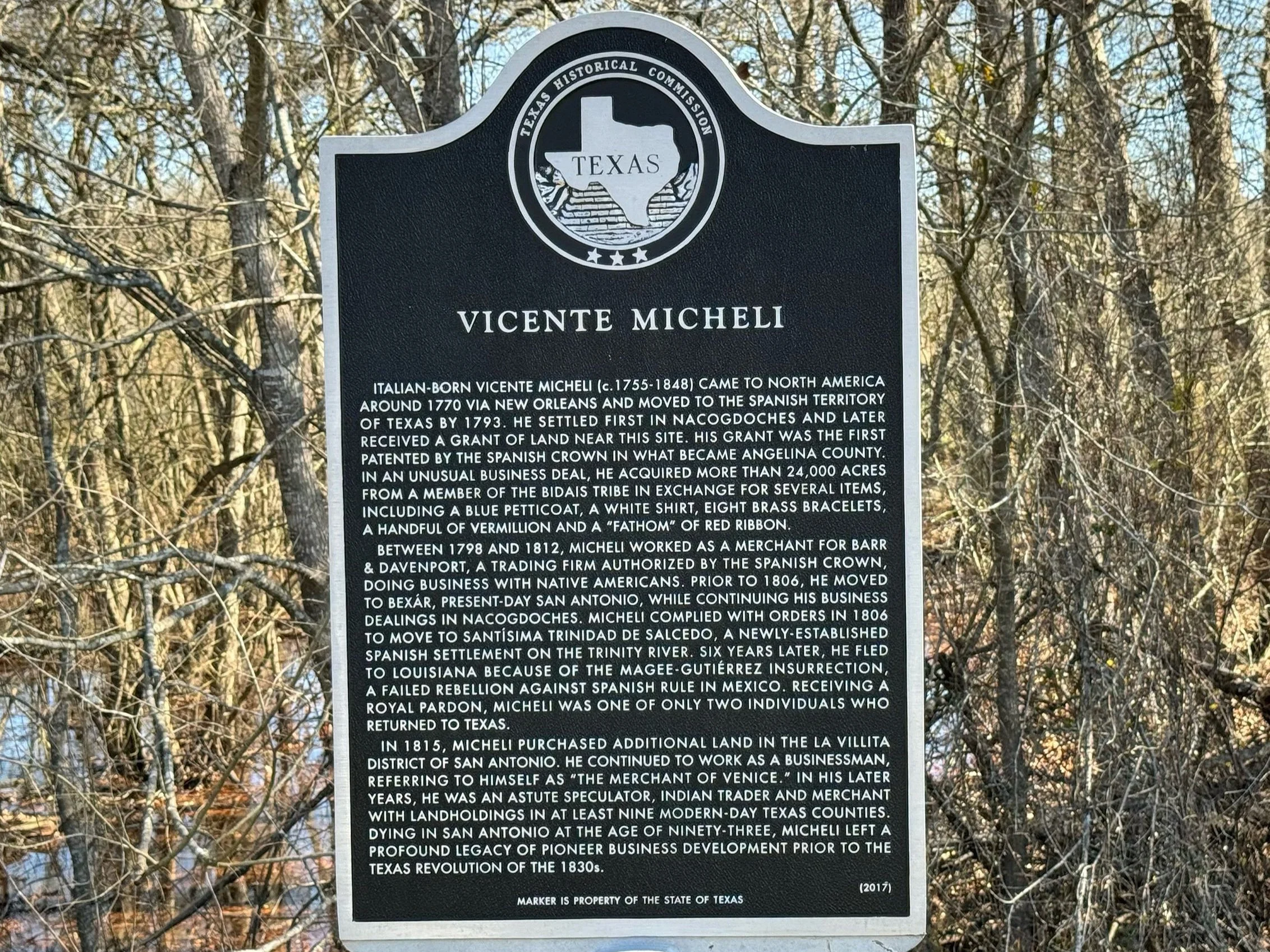
Random Texas Historical Marker
I’ve always said I’m a sucker for wanting to stop any time I see a sign that says “historical marker.” So I stopped at this one. I’m going to guess these can generally be hit or miss. Which one was this? You tell me… lol.

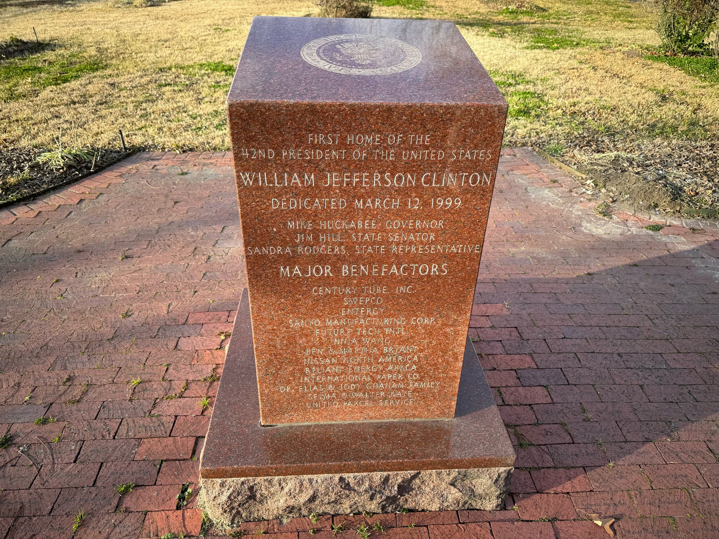
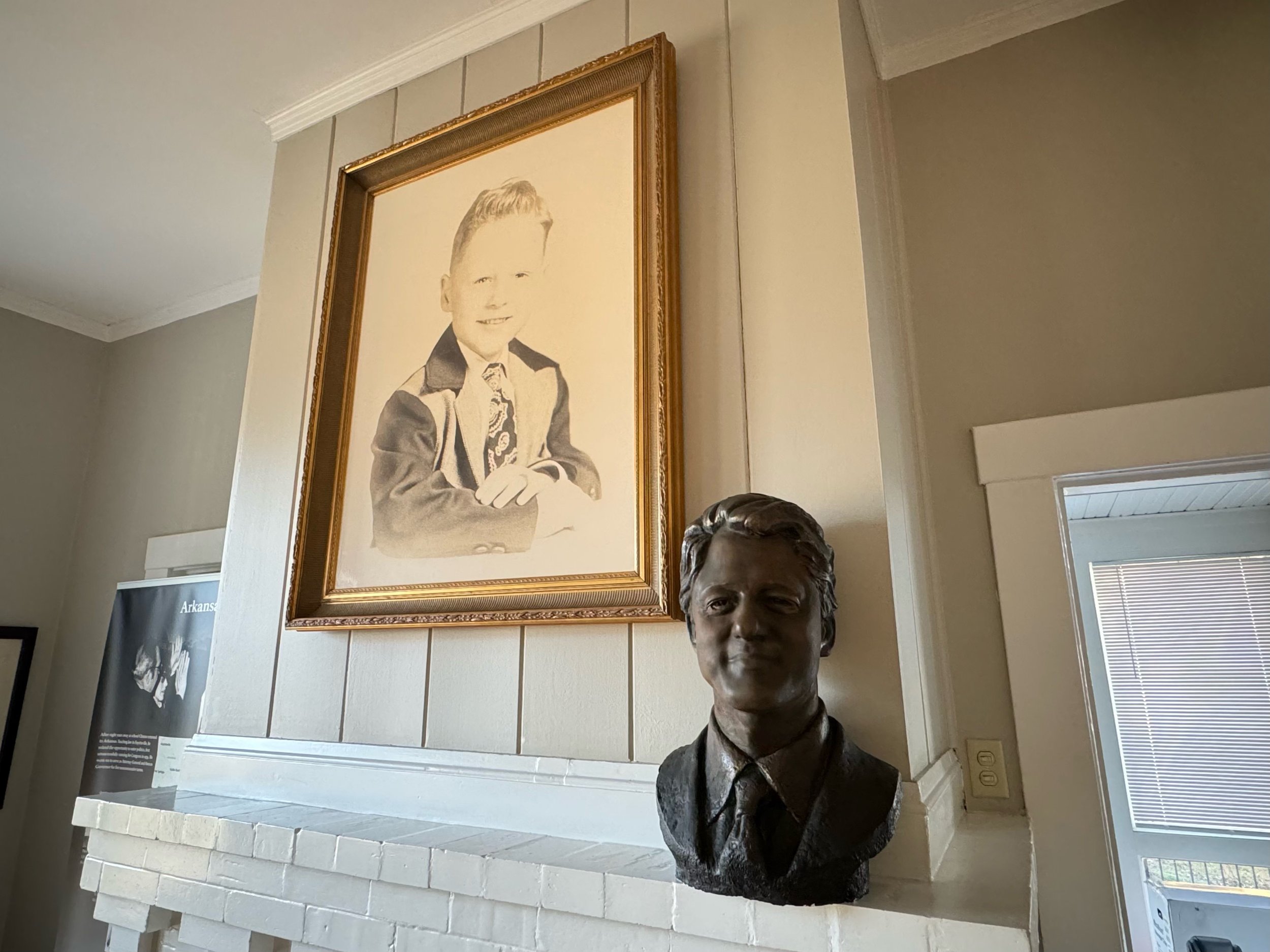
President William Jefferson Clinton Birthplace Home National Historic Site
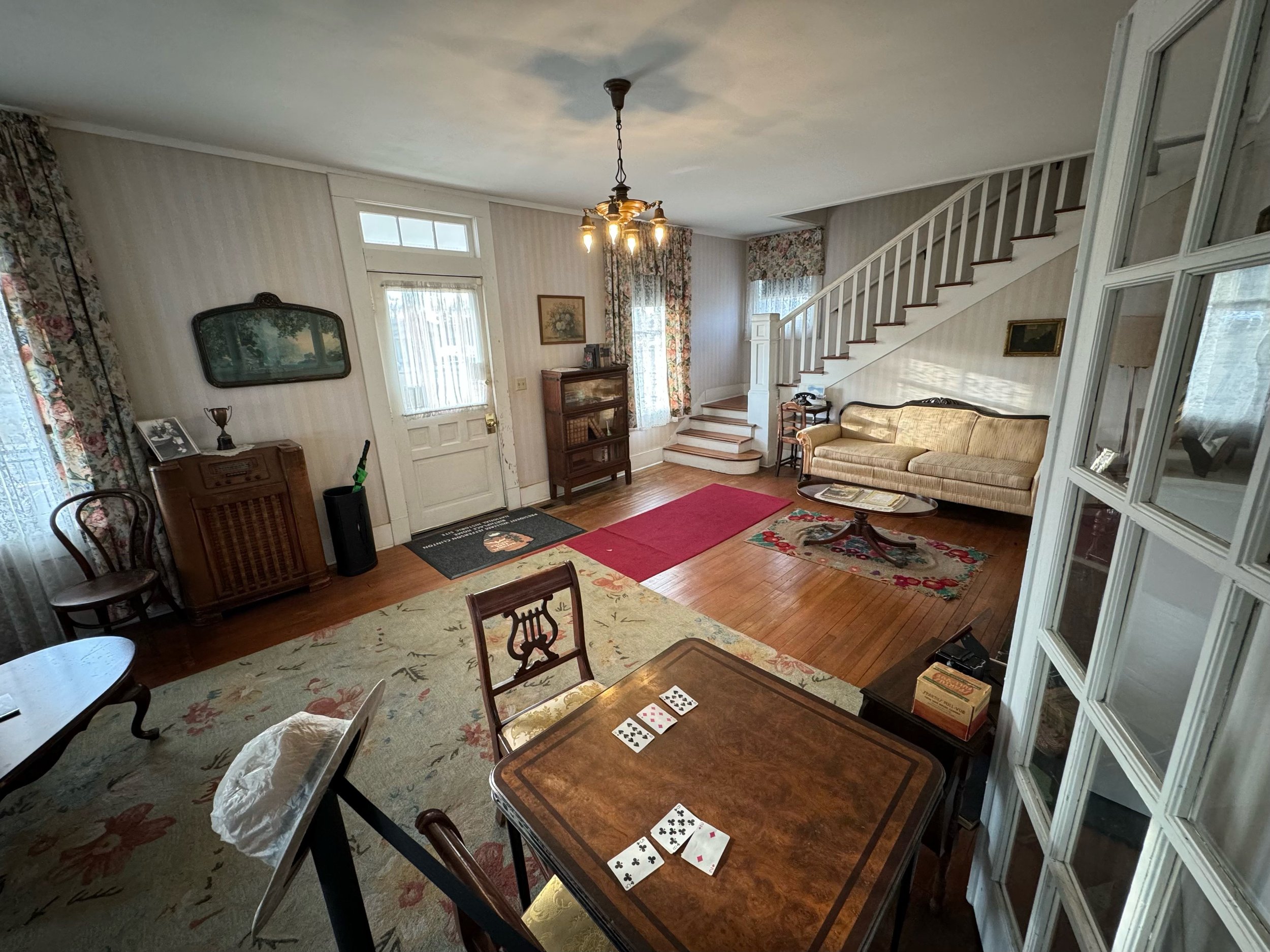
This wasn’t necessarily a destination for us either but it was an easy one to hit - a minute or two from the highway and it was pretty cool! We’re making pretty good progress on hitting all the presidents’ homes - at least the ones that are available to see. Some presidents have more than one, some there aren’t any, and some like Bill Clinton for example you probably just can’t randomly visit because they actually might be hanging out at their current home lol… But the house he came home to when he was born and spent his first 4 years at in Hope, Arkansas is a National Historic Site now administered by the National Park Service. We got a quick tour - the furnishings aren’t original because it changed ownership well before there was any idea that this site would have national significance, but they’ve done a good job restoring it to the time period of the late ‘40’s and there are a few items of note such as a book little Billy Blythe owned when he was a child that is on display in his bedroom (his name before his mother remarried - his biological father was tragically killed in a car accident before he was born).


Spring Hill Battlefield, Tennessee
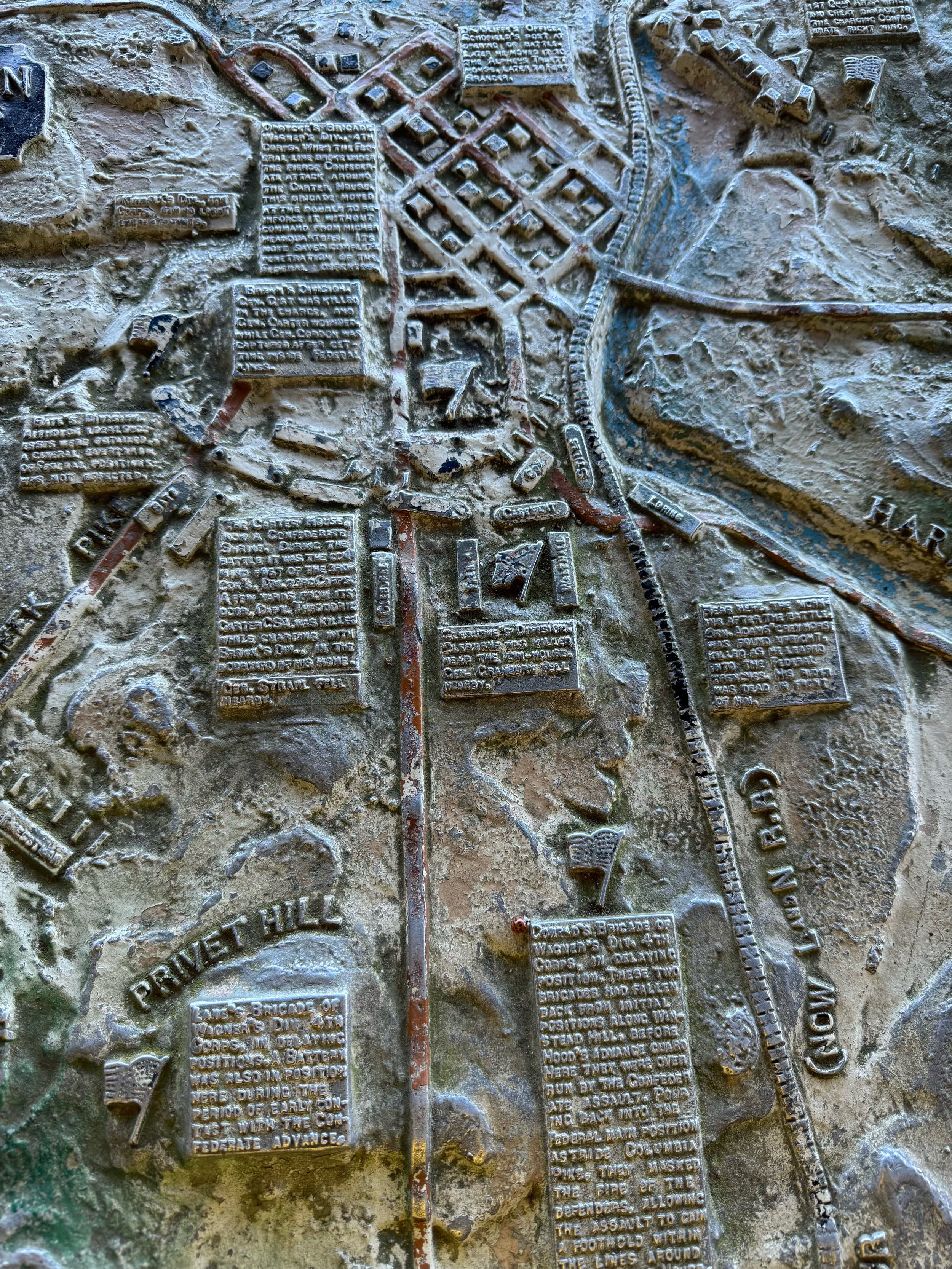
There was actually more to see here than I anticipated. There is no visitor center and it’s just one main field, but it’s a pretty decent sized tract of land where some fierce fighting occurred with a trail and interpretive markers. Worth a stop as part of Confederate General John Bell Hood’s desperate Tennessee Campaign - this battle was Hood’s only chance really to isolate Union General John Schofield’s Army of the Ohio and do some damage, but Schofield deftly escaped Northward to Franklin during the night and started digging the earthworks that would provide the defense lines for the following evening’s epic clash at Franklin. Hood blamed everyone but himself for the failure. However Hood was given some intel that Schofield’s men were heading North and he didn’t think it was the full army… Also Confederate General Nathan Bedford Forrest seemed to have made a pretty big miscalculation according to one of the interpretive battlefield markers below by sending Brigadier General James Chalmers into harms way sending him to attack Union Brigadier General George Wagner’s division (you can see the spot on the map below all along the Rally Hill Pike where Chalmers’ men charge against Bradley’s men and then retreat with the dotted red arrows). Chalmers protested but Forrest insisted that it was just a small cavalry force and ordered Chalmers to clear them off the hill. Bad call… Wagner’s men opened fire with plenty of force and Chalmers was forced to retreat.

Map by Hal Jespersen, www.cwmaps.com (Preserved Area box added by me)


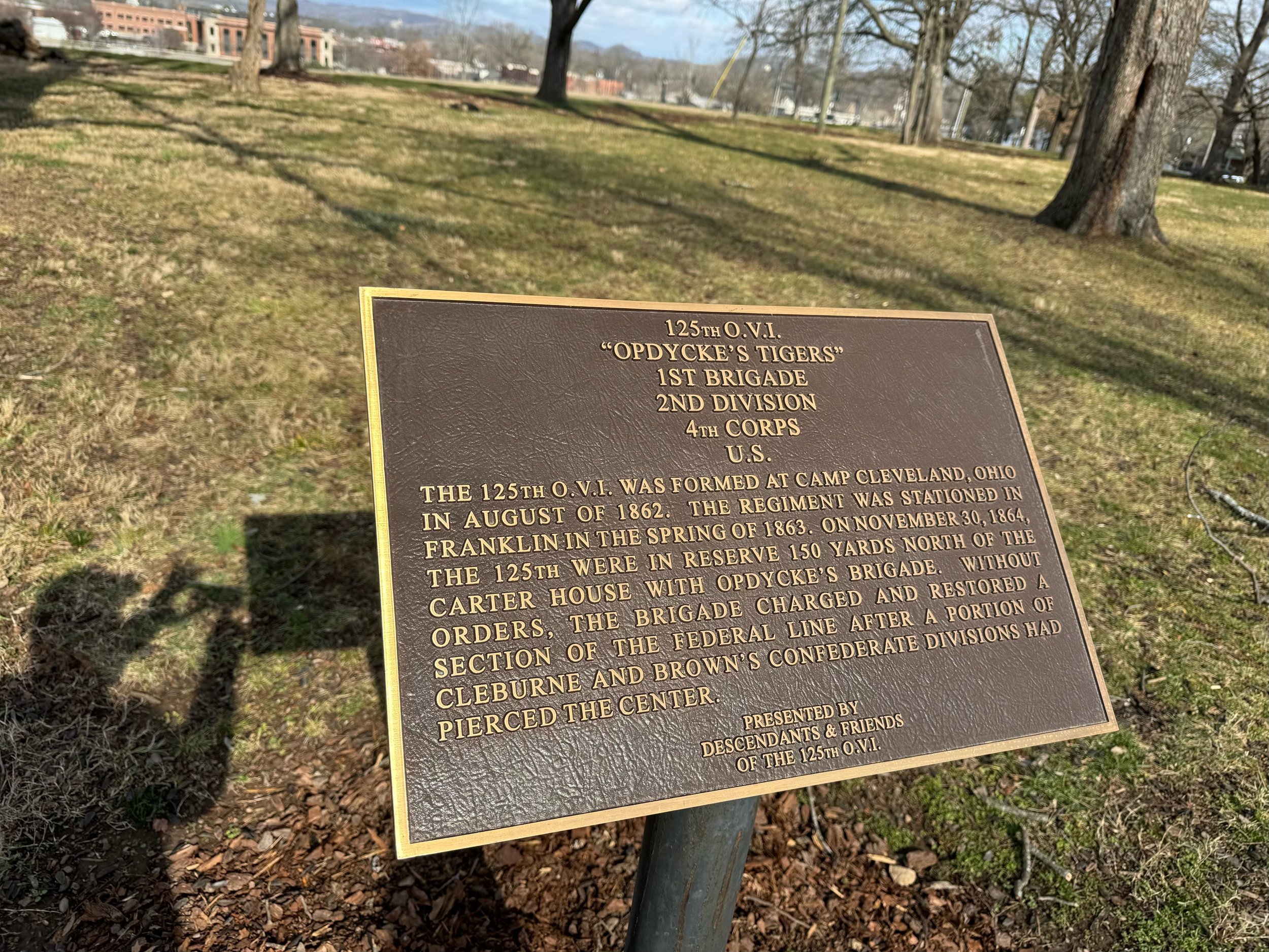
Franklin Battlefield, Tennessee
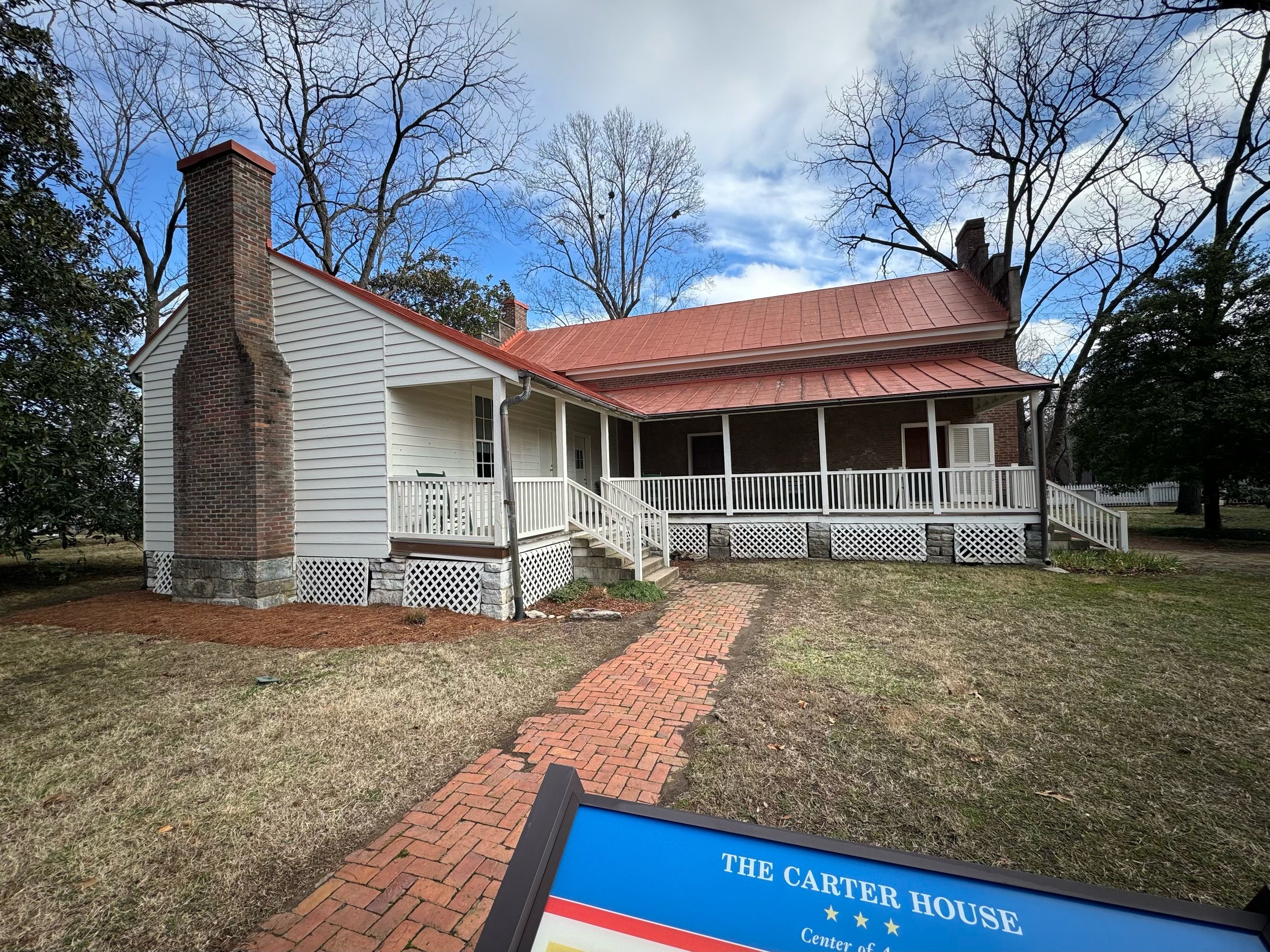
I visited Franklin in 2001 and there wasn’t a whole lot to see. Most of the battlefield had been lost to development and, while that’s still the case overall there has been incredible progress in reclaiming some significant land to give a much better feel for the battle. The restoration that has happened is remarkable. 181 acres have been saved which isn’t the most they’ve saved before, but it’s which acres that matter. Some of the heaviest fighting happened right around the Carter House and this is where land has been acquired, commercial buildings torn down (including a freaking Pizza Hut) and excavations done to determine exactly where the battle lines were along with the foundation of the Carter Farm Cotton Gin. They’ve been able to carve out a true battlefield park in the center of town that gives you some perspective of the fight here where there used to be none. There’s still one commercial structure which they should have the green light to remove this year to complete another significant piece of the puzzle. There’s a fascinating interview at the American Battlefield Trust website about the battle and the history of the battlefield with historians Robert Hicks and Eric Jacobson.

Map by Hal Jespersen, www.cwmaps.com
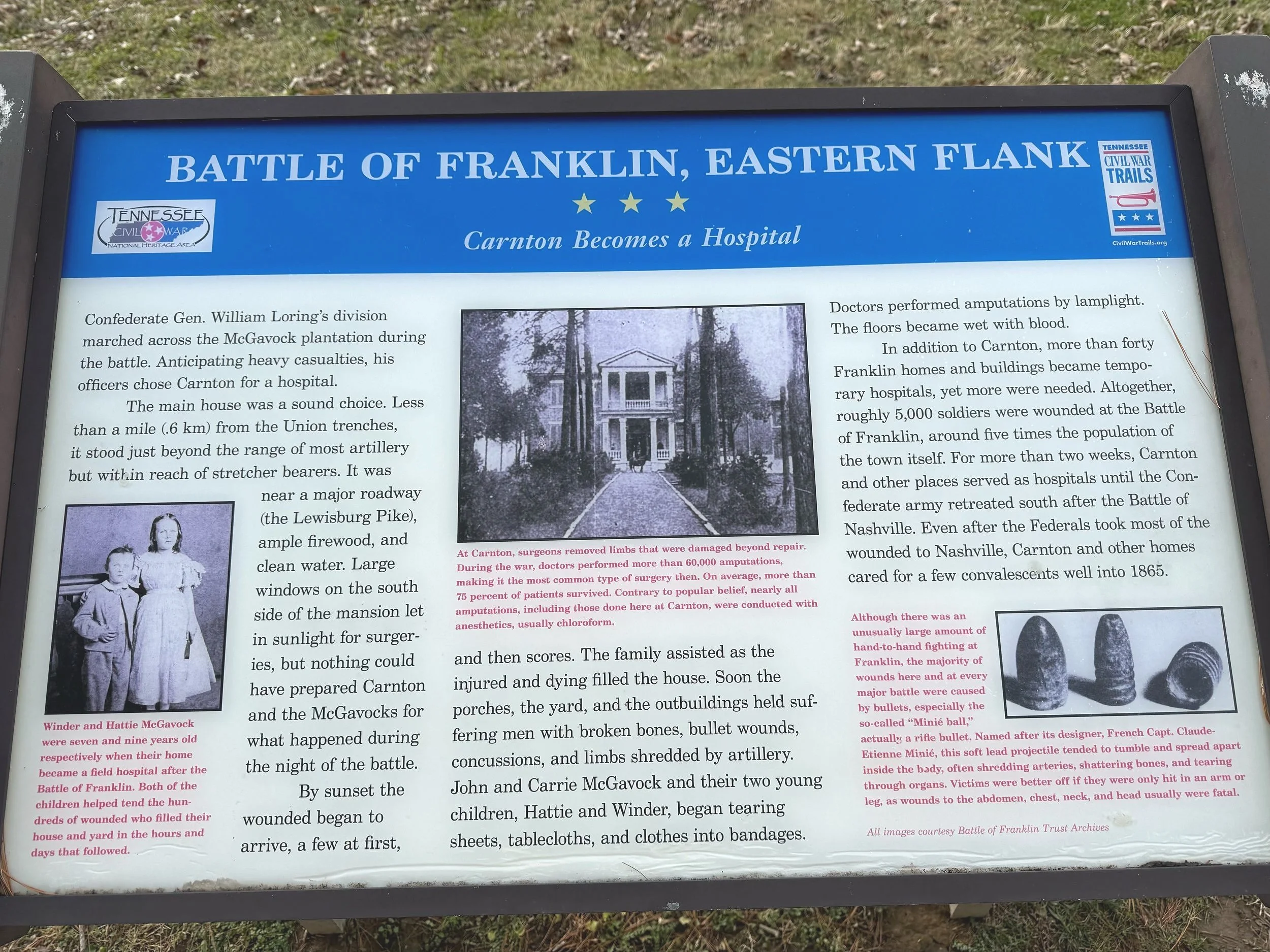
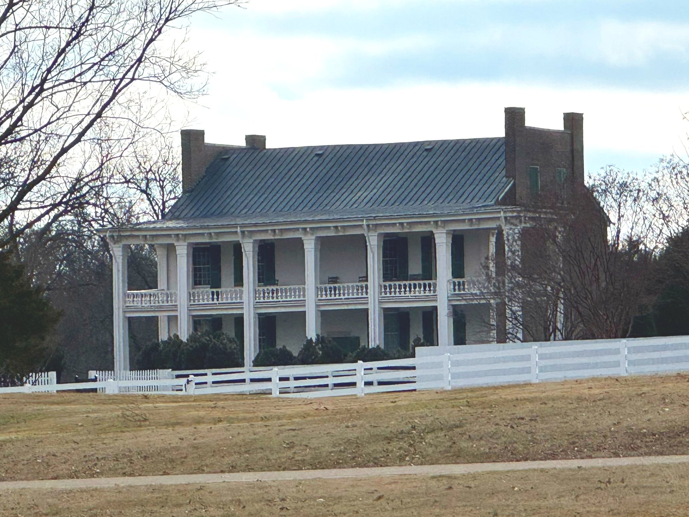
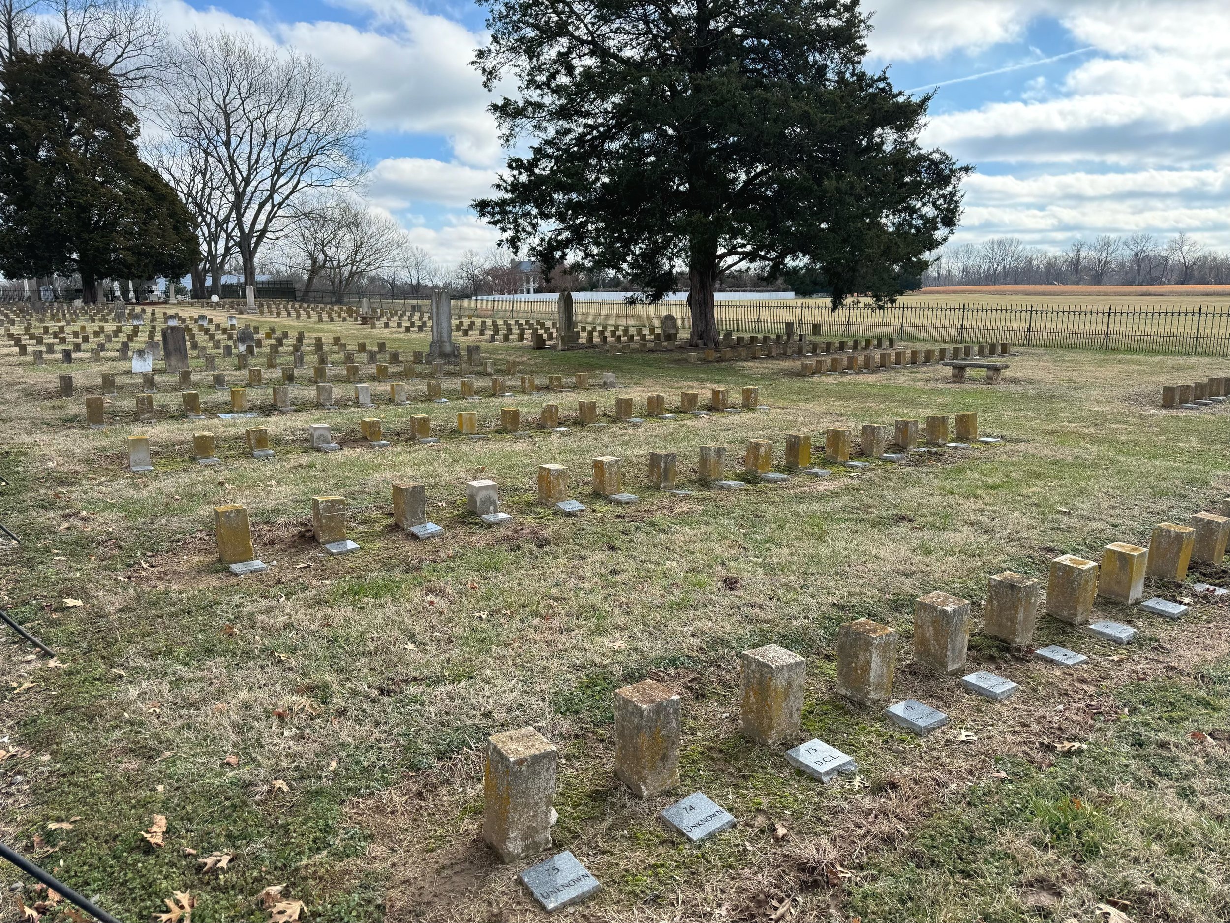
6 Confederate generals were killed in this battle including Patrick Cleburne - the “Stonewall of the West” and some of them were laid out on the porch of the Carnton House after the battle. I’ve been to several fields where Cleburne commanded troops including his first one at Richmond, KY. In 2001 you were able to basically drive up to that house and look around. Now there is a separate visitor center there and there is a charge to access the grounds. We didn’t take the time to do that - we were a little too limited on time, but they’ve also added trails and markers to the fields in front of the house that we took a look at.
The Confederates suffered 6,000 casualties on the evening of November 30th 1864 in FIVE HOURS. A massive desperate assault by Confederate General John Bell Hood on a scale about equal to Pickett’s Charge at Gettysburg trying to recapture some ground in Tennessee as Union General William T. Sherman was marching in the other direction to the sea after Atlanta fell. Not only didn’t the massive frontal assault succeed, Hood still pursued Union General John Schofield’s Army of the Ohio as they pulled back to defend Nashville. Schofield was joined by Union General George Thomas’s Army of the Cumberland and together they attacked Hood effectively destroying the Army of Tennessee - the end of Hood’s Army as a fighting force. The rebels entered Tennessee with about 30,000 troops and limped out of there with about half that number.
We started at the Confederate Eastern Flank really in the rear away from the heaviest fighting at the aforementioned Carnton House. I’ve included photos of the field that includes a path with kiosks and interpretive markers and the Confederate cemetery there.


Next we headed to the center of town by the Carter House where the heaviest fighting took place. I’ve included photos of the park there along with the structure of the house itself. Here is another map of the battle that includes which parcels of land have been acquired and protected - really cool (I like the first map a little better for the battle but this one shows the preservation and the spots where each Confederate General was killed). Go to the American Battlefield Trust and help protect more of these hallowed grounds!
I have too many photos to share here but I’ll try to give a good idea of what’s there. You can pretty much see all the spots on the map above that correspond to my photos. There are walking paths made of woodchips and there are paths of rocks which actually represent the Union battle line around the Carter House. The Carter House stands at the center of the action along with the separate structures that are still standing - the kitchen, the farm office, the smokehouse and the slave quarters.


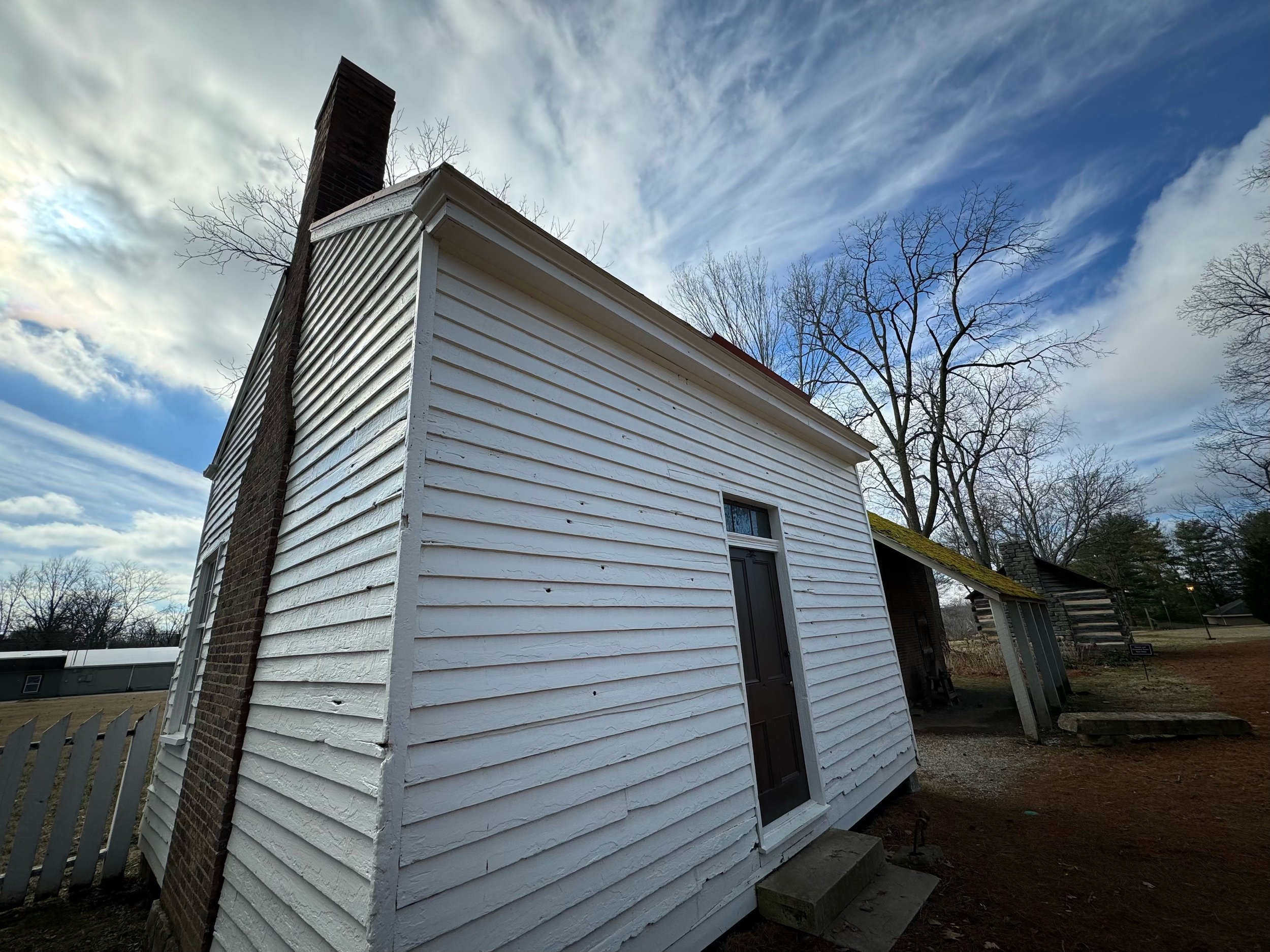


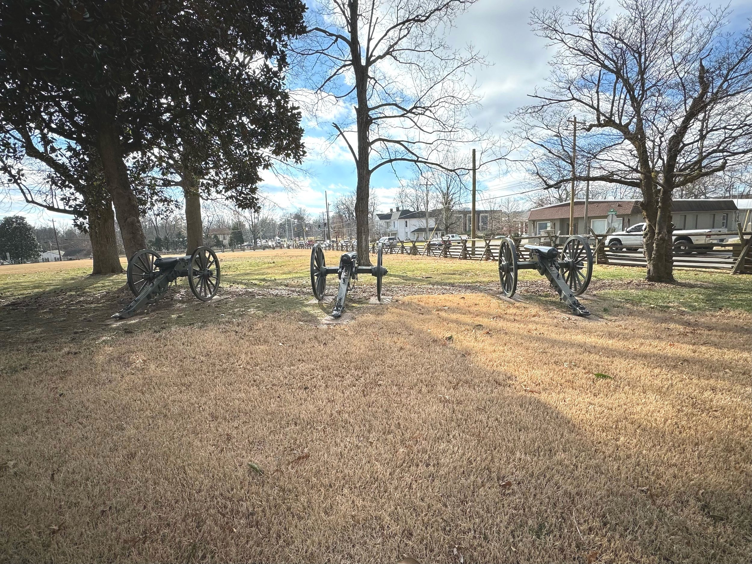


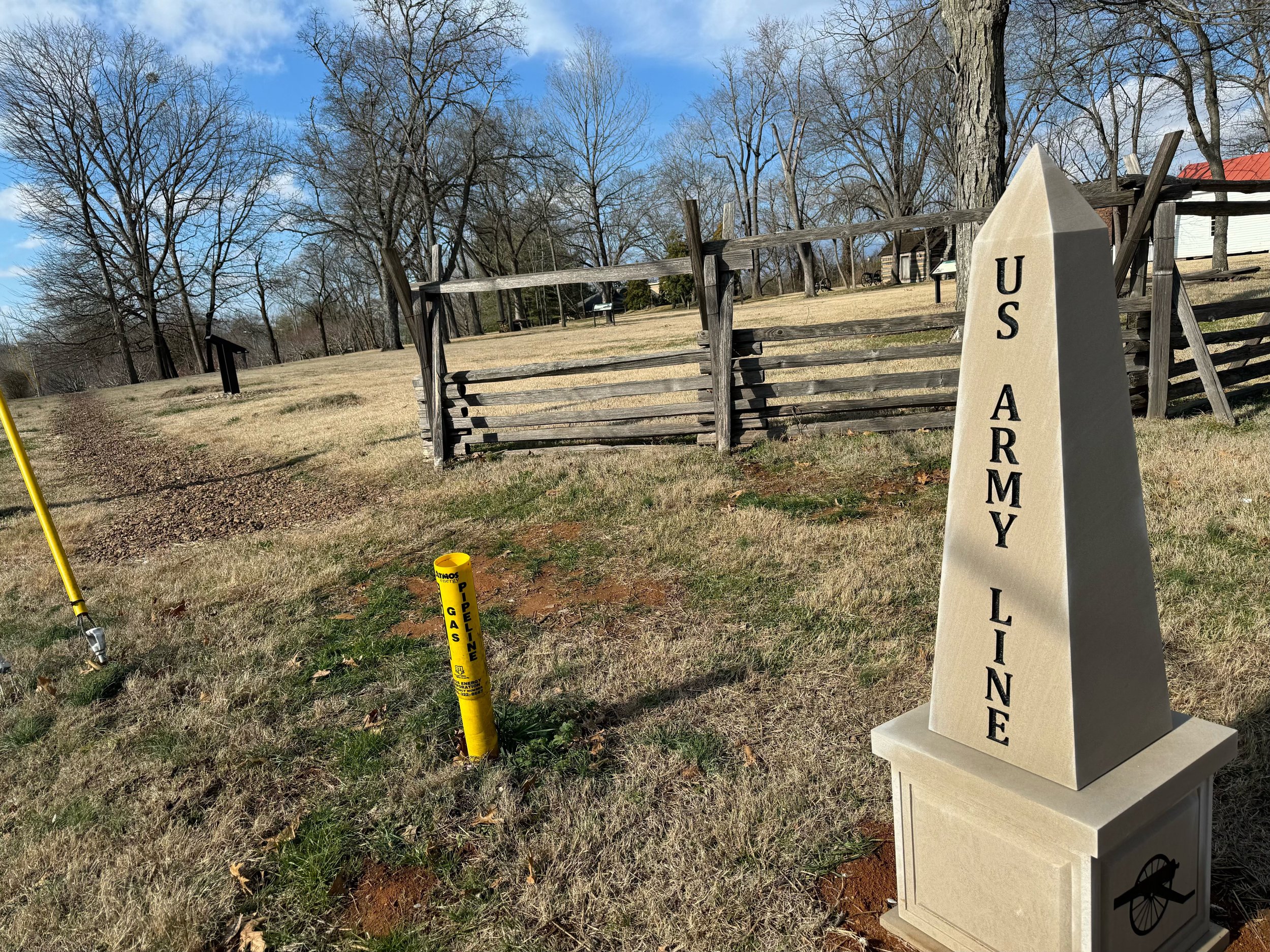


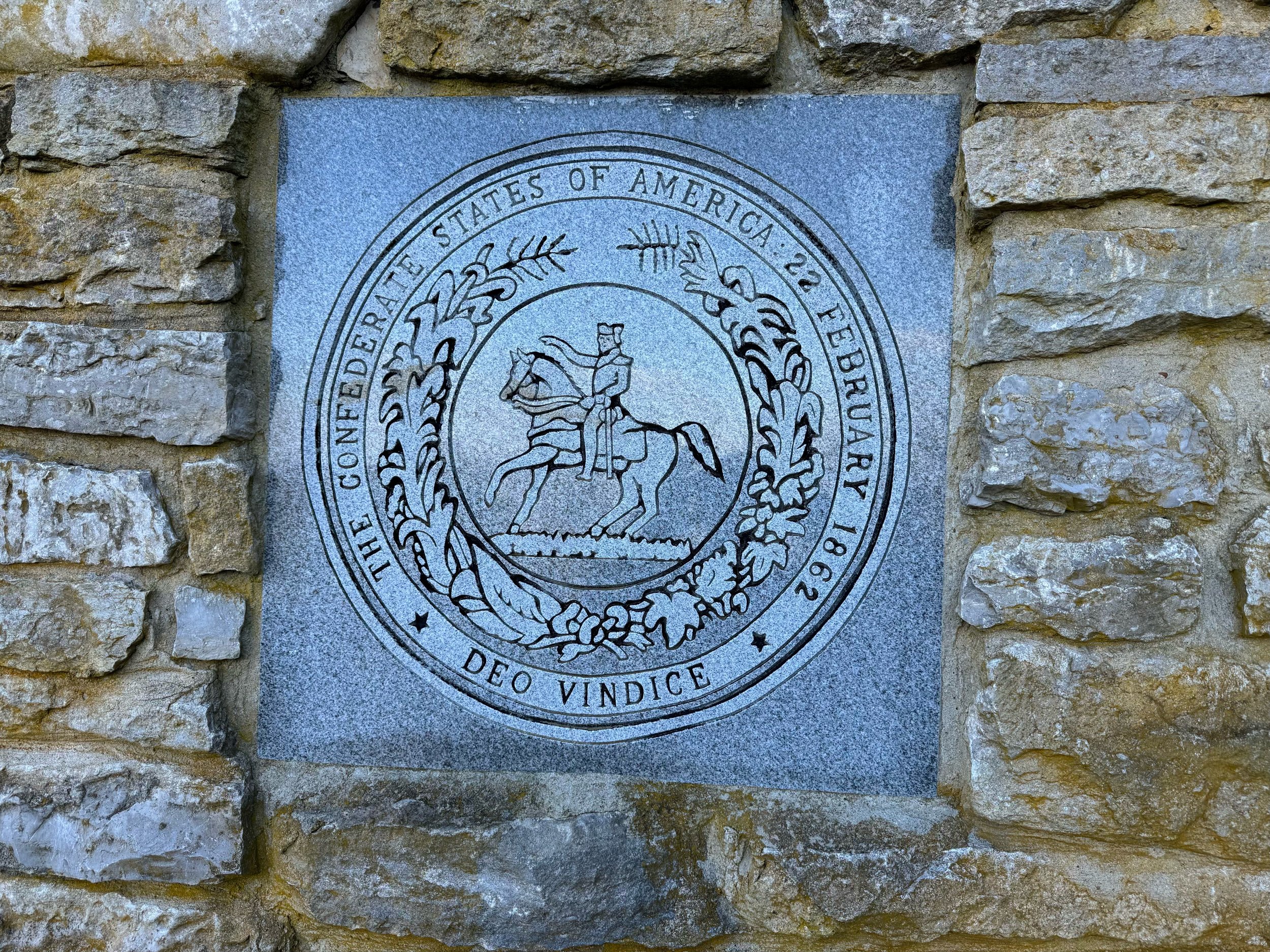
Last stop was Winstead Hill south of town where the signal was given to launch the attack and where General Hood observed the battle. It’s a commanding view and there are a bunch of monuments - ALL to the Confederacy…. Listen, I get including monuments to all of the soldiers who fought and died on these hallowed grounds - North and South. Heck in many cases it was neighbor vs. neighbor and brother vs. brother. On the bloody fields themselves is where the idea of not erasing history even if it’s not good holds water, as opposed to a Lost Cause statue erected in a southern city somewhere in 1920 to make a statement and intimidate. And yes this spot is from the Confederate position. But I don’t believe there is a similar park north of town from the Union position… I don’t know man…. I’m including just a few photos of what’s there. You can see the “Brigadier’s Walk” in the distance behind the Cleburne monument with monuments to the other Confederate generals who were killed in action that day. Generals who were “largely non-slave owning” - that somehow makes it feel worse, not better. I also find it pretty interesting that the word “Cause” is capitalized on the “Tennessee, A Grave Or A Free Home” plaque…. a Cause “they knew was right” no less… I feel like they could, um…. do a little better on these. Do we still need such overt Lost Cause messaging here? I’ll answer that - no. No, we don’t.


From Franklin we drove the rest of the way home to Michigan. But what a trip…. one we’ll never forget. Witnessing a National Championship and learning a ton of history? That’s pretty peak for me. I hope you enjoyed the highlights - leave your questions and comments below!!!
M10 Social is owned by Doug Cohen in West Bloomfield, MI and provides social media training and digital marketing services from the Frameable Faces Photography studio Doug owns with his wife Ally. He can be reached there at tel:248-790-7317, by mobile at tel:248-346-4121 or via email at mailto:doug@frameablefaces.com. You can follow Doug’s band Vintage Playboy at their Facebook page here. You can also visit our other business Detroit Jerky at the website www.DetroitJerkyLLC.com!
******************************************************************************************
Tune in to the 📷Doug&Ally📷Morning Show T-F between 8:30 & 11 EST UTC-4 on Heckle by following them on Heckle or Twitter at @frameablefaces! Also check out the Doug & Ally Morning Show podcast at anchor.fm/frameablefaces and everywhere you listen to podcasts! Doug also tweets at @dougcohen10 and @M10Social!